Established 1914 Local time Monday 12:59 AM | Postal code (street) 2770 Area code 053 | |
 | ||
Weather 17°C, Wind E at 5 km/h, 84% Humidity | ||
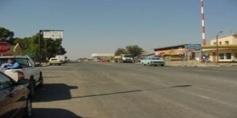
Delareyville is a maize and peanut farming town situated in North West Province of South Africa.
Map of Delareyville, 2770, South Africa
Town 96 km south-west of Lichtenburg, 82 km north-east of Vryburg, 114 km north-west of Wolmaransstad, and 61 km north of Schweizer-Reneke. It was laid out in 1914 and declared a border industry area in 1968. It was named after Jacobus Herculaas (Koos) de la Rey (1847-1914), General of the Boer forces in the Anglo-Boer War.
References
Delareyville Wikipedia(Text) CC BY-SA
