
Country United States FIPS code 31-12525 Area 230 ha Zip code 68020 Local time Sunday 2:01 AM | Time zone Central (CST) (UTC-6) GNIS feature ID 0828631 Elevation 326 m Population 462 (2013) Area code 402 | |
 | ||
Weather 10°C, Wind S at 24 km/h, 76% Humidity | ||
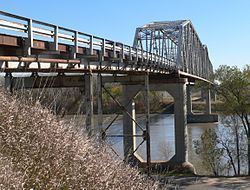
Decatur is a village in Burt County, Nebraska, United States, adjacent to the Missouri River. The population was 481 at the 2010 census. This town is named after one of its incorporators, Stephen Decatur.
Contents
Map of Decatur, NE 68020, USA
History
The area was originally populated by Omaha Indians. Explorers Meriwether Lewis and William Clark passed through the area in 1804 as they traveled along the Missouri River.
The first European settler in the area was a man named Woods, who settled at the mouth of Wood Creek (his namesake) in 1837. Stephen Decatur arrived in the area in 1841. His farm was called Decatur Springs, after a spring which supplied water to the village for the next century.
In 1854 the U.S. Commissioner of Indian Affairs purchased 300,000 acres of land from the Omaha, including the area which is now Decatur. The town of Decatur was incorporated in 1856 under the name "The Decatur Townsite & Ferry Company." The other incorporators included Thomas Whiteacre, T. H. Hineman, George Mason, and Herman Glass. Important Nebraska settler Peter Sarpy, who ran an Indian trading post at the mouth of Wood Creek, helped lay out the town. The patents for the town were granted on May 1, 1862. Following the dissolution of the Decatur Townsite and Ferry Company, the town was renamed Decatur Village in 1858.
Geography
Decatur is located at 42°0′22″N 96°15′4″W (42.006018, -96.250982).
According to the United States Census Bureau, the village has a total area of 0.90 square miles (2.33 km2), all of it land.
2010 census
As of the census of 2010, there were 481 people, 240 households, and 136 families residing in the village. The population density was 534.4 inhabitants per square mile (206.3/km2). There were 275 housing units at an average density of 305.6 per square mile (118.0/km2). The racial makeup of the village was 89.0% White, 0.6% African American, 7.1% Native American, 0.2% Asian, 1.0% from other races, and 2.1% from two or more races. Hispanic or Latino of any race were 1.7% of the population.
There were 240 households of which 20.0% had children under the age of 18 living with them, 42.5% were married couples living together, 7.1% had a female householder with no husband present, 7.1% had a male householder with no wife present, and 43.3% were non-families. 38.8% of all households were made up of individuals and 21.7% had someone living alone who was 65 years of age or older. The average household size was 2.00 and the average family size was 2.62.
The median age in the village was 52.9 years. 17% of residents were under the age of 18; 4.2% were between the ages of 18 and 24; 16% were from 25 to 44; 37% were from 45 to 64; and 25.8% were 65 years of age or older. The gender makeup of the village was 48.6% male and 51.4% female.
2000 census
As of the census of 2000, there were 618 people, 278 households, and 180 families residing in the village. The population density was 681.4 people per square mile (262.2/km²). There were 368 housing units at an average density of 405.8 per square mile (156.1/km²). The racial makeup of the village was 87.70% White, 0.65% African American, 7.93% Native American, 0.32% Asian, and 3.40% from two or more races. Hispanic or Latino of any race were 0.81% of the population.
There were 278 households out of which 26.6% had children under the age of 18 living with them, 52.5% were married couples living together, 7.2% had a female householder with no husband present, and 34.9% were non-families. 33.1% of all households were made up of individuals and 17.3% had someone living alone who was 65 years of age or older. The average household size was 2.22 and the average family size was 2.80.
In the village, the population was spread out with 23.5% under the age of 18, 4.5% from 18 to 24, 22.7% from 25 to 44, 28.3% from 45 to 64, and 21.0% who were 65 years of age or older. The median age was 45 years. For every 100 females there were 97.4 males. For every 100 females age 18 and over, there were 89.2 males.
As of 2000 the median income for a household in the village was $30,125, and the median income for a family was $37,857. Males had a median income of $25,938 versus $20,114 for females. The per capita income for the village was $14,118. About 8.0% of families and 9.4% of the population were below the poverty line, including 8.0% of those under age 18 and 12.9% of those age 65 or over.