
Country United States FIPS code 29-19378 Elevation 226 m Zip code 64639 Population 122 (2013) | Time zone Central (CST) (UTC-6) GNIS feature ID 0716763 Area 62 ha Local time Saturday 3:35 PM Area code 660 | |
 | ||
Weather 21°C, Wind S at 26 km/h, 22% Humidity | ||
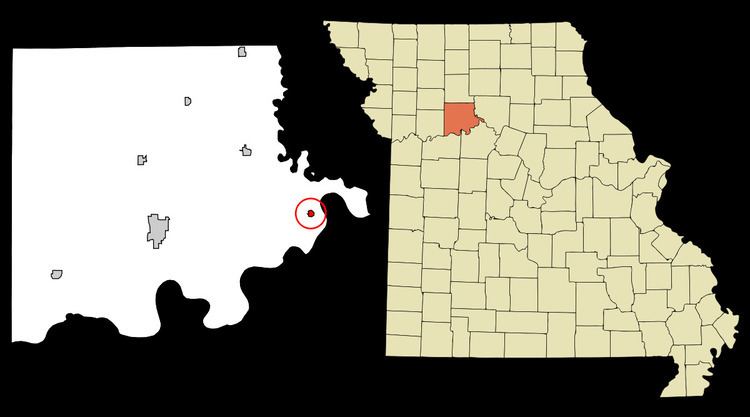
De Witt is a city in Carroll County, Missouri, United States. The population was 124 at the 2010 census, a net increase of 4 since the 2000 census.
Contents
Map of De Witt, MO 64639, USA
History
A post office called De Witt has been in operation since 1842. The community was named for DeWitt Clinton, governor of New York.
Geography
De Witt is located at 39°23′6″N 93°13′13″W (39.384991, -93.220349).
According to the United States Census Bureau, the city has a total area of 0.24 square miles (0.62 km2), all of it land.
2010 census
At the 2010 census, of 2010, there were 124 people, 49 households and 33 families residing in the city. The population density was 516.7 inhabitants per square mile (199.5/km2). There were 56 housing units at an average density of 233.3 per square mile (90.1/km2). The racial makeup of the city was 90.3% White, 5.6% African American, and 4.0% from two or more races. Hispanic or Latino of any race were 0.8% of the population.
There were 49 households of which 32.7% had children under the age of 18 living with them, 59.2% were married couples living together, 4.1% had a female householder with no husband present, 4.1% had a male householder with no wife present, and 32.7% were non-families. 22.4% of all households were made up of individuals and 6.1% had someone living alone who was 65 years of age or older. The average household size was 2.53 and the average family size was 2.97.
The median age was 43.7 years. 25.8% of residents were under the age of 18; 4.9% were between the ages of 18 and 24; 20.1% were from 25 to 44; 29.1% were from 45 to 64; and 20.2% were 65 years of age or older. The gender makeup of the city was 48.4% male and 51.6% female.
2000 census
At the 2000 census, of 2000, there were 120 people, 42 households and 33 families residing in the city. The population density was 486.5 per square mile (185.3/km²). There were 55 housing units at an average density of 223.0 per square mile (84.9/km²). The racial makeup of the city was 91.67% White, 5.83% African American, 0.83% Native American, 0.83% Pacific Islander, and 0.83% from two or more races.
There were 42 households of which 42.9% had children under the age of 18 living with them, 66.7% were married couples living together, 7.1% had a female householder with no husband present, and 21.4% were non-families. 14.3% of all households were made up of individuals and 4.8% had someone living alone who was 65 years of age or older. The average household size was 2.86 and the average family size was 3.27.
28.3% of the population were under the age of 18, 11.7% from 18 to 24, 26.7% from 25 to 44, 24.2% from 45 to 64, and 9.2% who were 65 years of age or older. The median age was 32 years. For every 100 females there were 96.7 males. For every 100 females age 18 and over, there were 115.0 males.
The median household income was $28,500 and the median family income was $29,167. Males had a median income of $19,375 compared with $25,833 for females. The per capita income for the city was $15,030. There were no families and 6.9% of the population living below the poverty line, including no under eighteens and none of those over 64.