
Country United States County Jefferson Time zone Central (CST) (UTC-6) Elevation 153 m Zip code 63020 Local time Saturday 3:01 PM | Incorporated 1869 Area code(s) 636 314 Area 11.1 km² Population 6,474 (2013) | |
 | ||
Weather 21°C, Wind S at 16 km/h, 22% Humidity | ||
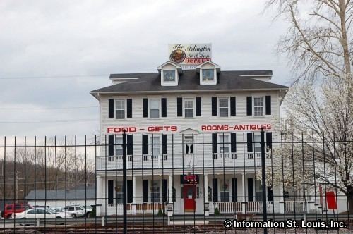
The arlington inn de soto missouri
De Soto is a city in Jefferson County, Missouri, United States. The population was 6,400 at the 2010 census and is part of the St. Louis metropolitan area. The Van Metre family were first to settle in 1803. The town was organized in 1857 and is named for the explorer Hernando De Soto, who claimed the Louisiana Territory for Spain. De Soto was the city closest to the mean center of U.S. population in 1980. The city celebrated its Bicentennial in 2003. The city made national news on and after May 6, 2003, when straightline winds and a tornado struck.
Contents
- The arlington inn de soto missouri
- Map of De Soto MO 63020 USA
- History
- Tornado Activity
- Local Attractions
- Geography
- 2010 census
- 2000 census
- Economy
- Education
- Notable people
- References
Map of De Soto, MO 63020, USA
History
De Soto was platted in 1857, and named after Hernando de Soto (c. 1496/1497–1542), Spanish conquistador. A post office has been in operation at De Soto since 1858.
The city is known as "Fountain City" because of the numerous artesian wells. Water from these wells and springs was bottled and shipped by tank car to the 1904 World Fair in St. Louis.
The Central School Campus and Louis J. and Harriet Rozier House are listed on the National Register of Historic Places.
Tornado Activity
On 12/21/1967, a category F4 tornado 16.8 miles away from the city center killed 3 people and injured 52 people and caused between $500,000 and $5,000,000 in damages.
On 6/22/1969, a category F4 (max. wind speeds 207-260 mph) tornado 13.5 miles away from the De Soto city center killed 2 people and injured 22 people and caused between $500,000 and $5,000,000 in damages.
On 4/22/1981, a tornado destroyed the Joachim Savings & Loan, the offices of the Republic and Press newspaper, and a tire store. One person was killed in the Savings & Loan.
On May 6, 2003 around 3:45pm, a tornado outbreak broke in Kansas, Missouri & Tennessee. At 5:14pm, a tornado touched-down 2 miles northwest of De Soto. 14 minutes later, the tornado sirens went off inside Jefferson County. The tornado hit De Soto as an EF-3, causing $12,800,000 in damage. The tornado destroyed the Junior High gymnasium, caused significant damage to the High School and Vineland Elementary, destroyed 58 houses & a local grocery store. It injured 23 and killed 9 inside De Soto.
Local Attractions
Geography
According to the United States Census Bureau, the city has a total area of 4.30 square miles (11.14 km2), all of it land.
2010 census
As of the census of 2010, there were 6,400 people, 2,629 households, and 1,633 families residing in the city. The population density was 1,488.4 inhabitants per square mile (574.7/km2). There were 2,927 housing units at an average density of 680.7 per square mile (262.8/km2). The racial makeup of the city was 95.8% White, 1.6% African American, 0.4% Native American, 0.4% Asian, 0.3% from other races, and 1.4% from two or more races. Hispanic or Latino of any race were 0.8% of the population.
There were 2,629 households of which 33.5% had children under the age of 18 living with them, 41.0% were married couples living together, 14.6% had a female householder with no husband present, 6.5% had a male householder with no wife present, and 37.9% were non-families. 31.6% of all households were made up of individuals and 13.5% had someone living alone who was 65 years of age or older. The average household size was 2.38 and the average family size was 2.97.
The median age in the city was 36.8 years. 24.8% of residents were under the age of 18; 8.9% were between the ages of 18 and 24; 26% were from 25 to 44; 24.2% were from 45 to 64; and 16.1% were 65 years of age or older. The gender makeup of the city was 47.2% male and 52.8% female.
2000 census
As of the census of 2000, there were 6,375 people, 2,544 households, and 1,656 families residing in the city. The population density was 1,673.6 people per square mile (646.0/km2). There were 2,741 housing units at an average density of 719.6 per square mile (277.8/km2). The racial makeup of the city was 96.71% White, 1.71% African American, 0.31% Native American, 0.19% Asian, 0.02% Pacific Islander, 0.27% from other races, and 0.80% from two or more races. Hispanic or Latino of any race were 1.02% of the population.
There were 2,544 households out of which 31.7% had children under the age of 18 living with them, 48.3% were married couples living together, 12.9% had a female householder with no husband present, and 34.9% were non-families. 29.8% of all households were made up of individuals and 15.0% had someone living alone who was 65 years of age or older. The average household size was 2.42 and the average family size was 2.99.
In the city the population was spread out with 25.3% under the age of 18, 8.8% from 18 to 24, 27.1% from 25 to 44, 20.2% from 45 to 64, and 18.6% who were 65 years of age or older. The median age was 37 years. For every 100 females there were 87.3 males. For every 100 females age 18 and over, there were 82.0 males.
The median income for a household in the city was $30,725, and the median income for a family was $37,486. Males had a median income of $33,163 versus $20,039 for females. The per capita income for the city was $14,971. About 11.4% of families and 14.7% of the population were below the poverty line, including 19.1% of those under age 18 and 12.1% of those age 65 or over.
Economy
The local economy is fueled by Union Pacific Railroad which operates a car repair shop on the east side of Main Street. Wal Mart, and De Soto School District #73 which are the largest employers.
Education
Public schools are run by the De Soto School District #73:
St. Rose of Lima School is the only private school in town ran by St. Rose of Lima Catholic Church.
The closest institution of higher education is in Hillsboro, Missouri at Jefferson College.