
 | ||
In urban design and urban planning, daylighting is the redirection of a stream into an above-ground channel. Typically, the goal is to restore a stream of water to a more natural state. Daylighting is intended to improve the riparian environment for a stream which had been previously diverted into a culvert, pipe, or a drainage system. In the UK, the practice is also known as deculverting.
Contents
- Natural drainage systems
- Example projects
- Vancouver British Columbia
- California
- New York State
- Seattle Washington
- In other countries
- References
The term also refers to the public process toward such projects. A general consensus has developed that protecting and restoring natural creeks' functions is achievable over time in an urban environment while recognizing the importance of property rights.
Natural drainage systems
Natural drainage systems help manage stormwater by infiltrating and slowing the flow of stormwater, filtering and bioremediating pollutants by soils and plants, reducing impervious surfaces, using porous paving, increasing vegetation, and improving related pedestrian amenities. Natural features — open, vegetated swales, stormwater cascades, and small wetland ponds — mimic the functions of nature lost to urbanization. At the heart are plants, trees, and the deep, healthy soils that support them. All three combine to form a "living infrastructure" that, unlike pipes and vaults, increase in functional value over time.
Some efforts to blend urban development with natural systems use innovative drainage design and landscaping instead of traditional curbs and gutters, pipes and vaults. One such demonstration project in the Pipers Creek watershed reduced imperviousness by more than 18 percent. The project built bioswales, landscape elements intended to remove silt and pollution from surface runoff water and planted 100 evergreen trees and 1,100 shrubs. From 2001 to 2003, the project reduced the volume of stormwater leaving the street in a 2-year storm event by 98%. Such a reduction can reduce storm damage to water quality and habitats for species such as the iconic salmon. Unfortunately, the engineering alternatives have a relatively expensive initial price, since they are usually replacing existing structures, albeit life-limited ones. Further, conventional systems generally do not consider full cost accounting. The NDS alternatives can also provide returns on investment by improving urban environments.
The Street Edge Alternatives Street breaks most of the conventions of 150 years of standard American street design. Narrow, curved streets, open drainage swales, and an abundance of diverse plants and trees welcome pedestrians as well as diverse species. Adjacent residents maintain city infrastructure in the form of street "gardens" in front of their homes, visually integrating the neighborhood along the street. The Natural Drainage System united the community visually, environmentally, and socially. The 110th Cascades SEA (2002–2003) are a creek-like cascade of stair-stepped natural, seasonal pools that intercept, infiltrate, slow and filter over 21 acres (85,000 m2) of stormwater draining through the project.
Example projects
Viable, daylighted streams can exist only in intimate connection with restoration and stewardship by the neighbourhoods of their watersheds in a long run, since the good health of an urban stream could not long survive carelessness or neglect. With impervious surfaces having replaced most of the natural ground cover in urban environments, halbitat for wildlife is dramatically reduced compared to historic baselines. Hydrologic changes have resulted, and impervious waterways directly carry non-point pollution through urban creeks. One effective solution is to restore streams and riparian habitat. This is improves the entire urban watershed, far beyond the riparian channel itself.
Vancouver, British Columbia
In the 1880s there were over 50 wild salmon streams in Vancouver alone. However, as Vancouver grew, these streams were lost to urbanization. They were covered by roads, homes, and businesses. They were also lost when they were buried beneath sewers or culverts.
The City of Vancouver and its residents are now making an effort to uncover these lost streams and restore them back to their natural state.
Hastings Creek
The Hastings Creek Stream Daylighting Project was originally proposed in 1994 as a way to manage storm water and for aesthetic purposes. The idea was to bring the stream back to its once natural formation which would improve the surrounding habitat for wildlife as well as the originally proposed purposes. This project's plan was finalized in 1997, and work began the same year.
The stream had existed in Hastings Park until 1935 when the Park became focused on entertainment rather than its original purpose when it was given to the city in 1889, which was to be a retreat for those with a passion for the outdoors. As the Pacific Nation Exhibition (PNE) grounds continued to expand there was a continued loss of natural woodlands, greenery and waterways. It was not until the 1980s when the surrounding community began to look at continuing to uphold its original purpose.
The daylighting project made major progress in 2013 in the area located in the Creekway Park, which was originally a parking lot. The daylighted stream will one day connect the Sanctuary in Hastings Park to the Burrard Inlet. The progress made in Creekway Park is a major step towards this goal. This daylighting project also improved pedestrian and bikeway transit. This stream is now able to obtain the stormwater from the surrounding area, which reduces the load that is felt by the municipality's storm sewers. It is the storms in early autumn which provide the water flow for the creek, meaning that there is variable flow throughout the year. During the late summer months the moist soil is relied upon to maintain the vegetation of the area. This variation in flow does not allow for salmon migration through the creek; however it does house trout as well as vegetation which aid in the filtration of the storm water entering the creek.
Spanish Banks
Located upstream from Spanish Banks waterfront, one of the highest profile creeks in Vancouver Metro became open to salmon in 2000. In a collaborative project between Spanish Banks Streamkeepers Association and the Department of Fisheries and Oceans Canada, barriers to fish passage were removed and habitat structure was added. Spanish Banks Creek was previously diverted through a culvert underneath a parking lot, but the lower reaches of this creek have been revitalized. The banks were stabilized with riprap, large woody debris was added for habitat cover, and spawning gravels were added in appropriate areas. Rigorous effectiveness monitoring has not been performed, but a few dozen coho and chum salmon are known to spawn there annually in a sustaining population. Maintenance to the creek is provided by Spanish Banks Streamkeepers Association, a local volunteer stewardship group.
St. George Rainway
The East Vancouver neighborhood of Mount Pleasant has officially incorporated into its community plan a project to restore St. George creek, a tributary to the False Creek watershed. St. George street is the site of this former stream, which now flows through the sewers and a culvert. This paved street will be converted into a shared-use path, riparian habitat, and urban greenspace.
St. George Creek once spawned salmon and trout, and hosted a diverse riparian ecosystem. The restoration of this habitat using the rainway proposal would allow for salmon spawning, recreational and educational opportunities, and improve the community's access to nature and transportation alternatives. The proposal would pass the following community centres: Great Northern Way Campus, St. Francis Xavier School, Mt. Pleasant Elementary, Florence N. Elementary, Kivan Boys and Girls Club, Robson Park Family Centre.
Detailed landscape designs have been produced, and incorporated into the community plan of Mount Pleasant neighborhood. Project leaders from the False Creek watershed Society and Vancouver Society of Storytelling have collaborated with Mount Pleasant Elementary students to create a street mural drawing attention to the belowground stream., To date, the mural is the only physical progress on the project.
Tatlow Creek
This is a future project aiming to ultimately connect the gap in the Seaside Greenway in order to link it to the Burrard Bridge. The beginning of this project has been started by the City of Vancouver in 2013, after its approval on July 29 of the same year. Volunteer Park is located in Kitsilano at the corner of Point Grey Road and Macdonald Street. This is where the main daylighting project for this area is planned to occur.
Phase one is currently in progress. Point Grey Road is currently closed to through motor traffic in order to turn the street into a greenway for cycling and walking. This part of the project is expected to be complete by summer 2014.
Phase two of this project is looking to include the daylighting of Tatlow Creek which is located in Volunteer Park. This phase must go through the City Council and the Park Board capital planning process for the 2015-2017 Capital Plan before any plans can be finalized.
Tatlow Creek had been scheduled to be daylighted in 1996, and the project to start in 1997. The project was deemed feasible and the storm water was to be diverted back into the natural creek bed and tunneled under Point Grey Road. When it was not done, the project was proposed again by a UBC masters' student as the Tatlow Creek Revitalization Project. If this project is completed as phase 2 of the new Park Board Project it would allow for salmon and trout spawning.
California
New York (State)
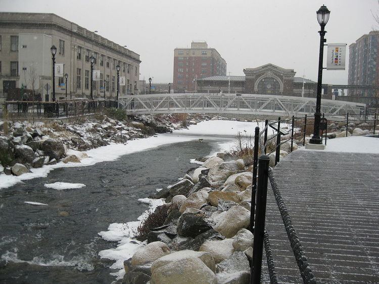
Yonkers, New York, the fourth largest city in the state, broke ground on December 15, 2010 on a project to daylight of the Saw Mill River as it runs through its downtown, called Getty Square. The daylighting project is the cornerstone of a large redevelopment effort in the downtown. An additional 2 other sections of the Saw Mill River are planned to be daylighted as well.
The first phase of the Yonkers daylighting was portrayed in the documentary Lost Rivers. The second phase, where the river runs under the Mill Street Courtyard, broke ground on March 19, 2014.
Seattle, Washington
Pipers Creek
Pipers Creek in the central to north Greenwood area is joined by Venema and Mohlendorph Creeks in Carkeek Park on Puget Sound. Pipers is one of the four largest streams in urban Seattle, together with Longfellow, Taylor, and Thornton creeks. Pipers Creek drains a 1,835-acre (7 km2) watershed into Puget Sound, from a residential upper plateau that is most of the watershed, through the steep ravines of the 216 acres (0.9 km2) of Carkeek Park. The headwaters begin in the north Greenwood neighborhood. Outside the park, the creek can be seen at N 90th Street between Greenwood and Palatine avenues N.
Years of hard work by neighbors and volunteers have brought salmon back to Pipers Creek, Venema, and Mohlendorph creeks in the mid-2000s after there were none for 50 years. The latter is named for the late Ted Mohlendorph, a biologist who spearheaded efforts to restore the watershed as salmon habitat.
Though still plagued by problems endemic to urban streams, Piper's Creek today is a scintillating example of the possible. Though augmented by hatchery fish, anywhere from 200 to 600 chum salmon return each November, along with a few coho in the fall and fewer occasional winter steelhead. Inspirationally, several hundred small resident coastal cutthroat trout live in the watershed, believed to be native fish that survived decades of urban assault. An environmental learning center and programs are part of comprehensive restoration. More than four miles (6 km) of trail are maintained by neighborhood volunteers who put in 4,000 hours of work in 2003, for example. The creek waters are pretty in their impressively restored settings, but the watershed is the surrounding neighborhoods and streets, laced with petrochemicals, pesticides, fertilizers, wandering pets, and such. Along with steeply high volume during storm runoff and resulting turbidity, water quality is the remaining big issue in restoring salmon.
The north fork of Pipers Creek is the site for the 110th Cascades, an S.E.A. (Street Edge Alternatives) street demonstration project (see above). The 110th Cascades are a creek-like cascade of stair-stepped natural, seasonal pools that intercept, infiltrate, slow and filter over 21 acres (85,000 m2) of stormwater draining through the project. The cascades are a part of an NDS (Natural Drainage Systems) project; together these united the community visually, environmentally, and socially, toward integrating the neighborhood as a community.
Pipers Creek was renamed Piper's Creek by 19th century settlers A. W. Piper and his large family; the apostrophe is becoming less common today.
Taylor Creek
Other areas
Citizens of neighborhoods initiated a daylighting project in 2001, encompassing from above 38th Avenue into Lake Washington. Daylighting will return the creek to a new bed and replace the sloping lawn between Lake Washington Boulevard and Lake Washington with native plantings, and with the mouth of the creek at a restored 48,000 sq ft (4,500 m2) wetland cove on the lake. New culverts under 38th, the boulevard, and under a permeable pedestrian path will allow fish passage. Native plantings will restore about 1.5 acres (6,100 m2), with plantings three to four feet in height at three key view corridors. Planning continued through 2004, followed by design (2205) and construction (2006). The completion celebration is scheduled for spring, 2007. The $450,000 cost is funded by community-initiated grants and private donations.
In other countries
Seoul provides one example of a major world city rediscovering its river. Mayor Lee Myung Bak, formerly a construction magnate with the Hyundai chaebol involved in burying the river during the 1960s boom, ran for office promising to daylight it, and achieved in 2005 a 5.8 kilometres (3.6 mi) greenspace in a city without very many parks [citation needed] or playgrounds. Although this is not a true daylighting project—the original seasonal and polluted stream runs below [citation needed] the stunningly engineered and landscaped new, artificial waterway —the Cheonggyecheon, "pristine stream", is hugely popular, alleviating fears that opening the river would cause nearby businesses to lose customers.
In the United Kingdom, an example of daylighting is occurring in Rochdale. The River Roch that runs through the town has recently been uncovered, revealing the medieval bridge in place. It was originally covered in 1904 due to the expanding tram network of the town, and the tram network has since closed.