
Country United States FIPS code 48-19420 Area 4.6 km² Zip code 76639 Local time Saturday 8:30 AM | Time zone Central (CST) (UTC-6) GNIS feature ID 1334106 Elevation 147 m Population 801 (2013) Area code 254 | |
 | ||
Weather 12°C, Wind SE at 10 km/h, 66% Humidity | ||
Dawson is a town in Navarro County, in the U.S. state of Texas. The population was 807 at the 2010 census.
Contents
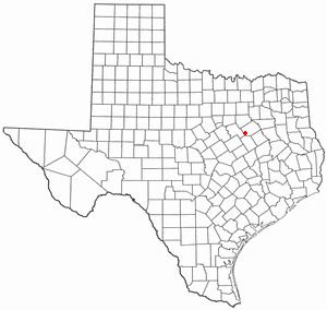
- Map of Dawson TX 76639 USA
- History
- Geography
- Demographics
- Education
- Braniff Flight 352
- Notable people
- Climate
- References
Map of Dawson, TX 76639, USA
History
The town was established in 1847 and was the second town established in the county.
Geography
Dawson is located at 31°53′44″N 96°42′55″W (31.895427, −96.715345).
According to the United States Census Bureau, the town has a total area of 1.8 square miles (4.7 km2), of which, 1.8 square miles (4.7 km2) of it is land and 0.56% is water.
Demographics
As of the census of 2000, there were 852 people, 361 households, and 229 families residing in the town. The population density was 480.8 people per square mile (185.9/km²). There were 408 housing units at an average density of 230.2 per square mile (89.0/km²). The racial makeup of the town was 80.99% White, 15.14% African American, 0.12% Native American, 0.12% Asian, 1.64% from other races, and 2.00% from two or more races. Hispanic or Latino of any race were 6.34% of the population.
There were 361 households out of which 25.2% had children under the age of 18 living with them, 46.8% were married couples living together, 13.0% had a female householder with no husband present, and 36.3% were non-families. 34.6% of all households were made up of individuals and 23.0% had someone living alone who was 65 years of age or older. The average household size was 2.36 and the average family size was 3.07.
In the town, the population was spread out with 24.1% under the age of 18, 7.6% from 18 to 24, 23.9% from 25 to 44, 21.7% from 45 to 64, and 22.7% who were 65 years of age or older. The median age was 40 years. For every 100 females there were 90.6 males. For every 100 females age 18 and over, there were 81.2 males.
The median income for a household in the town was $25,658, and the median income for a family was $40,441. Males had a median income of $30,250 versus $20,417 for females. The per capita income for the town was $13,190. About 13.2% of families and 20.9% of the population were below the poverty line, including 27.8% of those under age 18 and 27.1% of those age 65 or over.
Education
The Town of Dawson is served by the Dawson Independent School District.
Braniff Flight 352
Braniff Flight 352 was a scheduled domestic flight from William P. Hobby Airport in Houston, Texas to Dallas Love Field in Dallas, Texas. On May 3, 1968 a Lockheed L-188A Electra flying on the route, registration N9707C, broke up in mid air and crashed near Dawson, Texas after flying into a severe thunderstorm. It was carrying a crew of 5 and 80 passengers. There were no survivors. Investigation revealed that the accident was caused by the captain's decision to penetrate an area of heavy weather followed by a structural over-stress and failure of the airframe while attempting recovery from loss of control during a steep 180 degree turn executed in an attempt to escape the weather.
Notable people
Climate
The climate in this area is characterized by hot, humid summers and generally mild to cool winters. According to the Köppen Climate Classification system, Dawson has a humid subtropical climate, abbreviated "Cfa" on climate maps.