
Population 4,299 (2011 census) Dawesville West Coolup | Postcode(s) 6211 Postal code 6211 | |
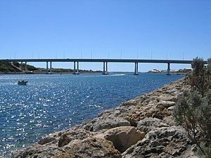 | ||
Dawesville is a suburb of Mandurah, and is located between the Harvey Estuary and the Indian Ocean.
Map of Dawesville WA 6211, Australia
It is also home to the largest inland waterway in Western Australia - the Harvey Estuary and the Peel Inlet which combine to produce an array of fishing and crabbing options in the summer months. However, due to the crab population declining over the past half-decade, September and October and now banned from crabbing in the estuary.
Attractions outside crabbing and fishing include canoeing,jet-ski and skiing, whilst being only 500 metres from the beach over the highway is another attraction. Pyramids Beach, the most popular beach in Dawesville, is currently undergoing development of the beach to make it a future surf spot.
References
Dawesville, Western Australia Wikipedia(Text) CC BY-SA