
Country Philippines Barangays ZIP code 9610 Local time Saturday 12:39 PM | Established July 18, 2000 Time zone PST (UTC+8) Area 461.1 km² Province Maguindanao | |
 | ||
Region Autonomous Region in Muslim Mindanao (ARMM) Weather 32°C, Wind NE at 11 km/h, 52% Humidity | ||
Datu Montawal (formerly Pagagawan) is a 5th class municipality in the province of Maguindanao, Philippines. According to the 2015 census, it has a population of 34,820 people.
Contents
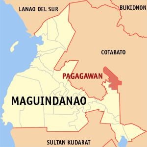
Map of Pagagawan, Maguindanao, Philippines
The municipality, then known as Pagagawan, was created under Muslim Mindanao Autonomy Act No. 95 on July 18, 2000, carved out of the municipality of Pagalungan. It was renamed to Datu Montawal under Muslim Mindanao Autonomy Act No. 152 on January 7, 2002.
Barangays
Datu Montawal is politically subdivided into 11 barangays.
References
Datu Montawal, Maguindanao Wikipedia(Text) CC BY-SA