
Country United States FIPS code 30-19300 Elevation 1,184 m Zip code 59829 Local time Friday 8:24 AM | Time zone Mountain (MST) (UTC-7) GNIS feature ID 0782081 Area 150 ha Population 733 (2013) Area code 406 | |
 | ||
Weather 2°C, Wind S at 6 km/h, 60% Humidity | ||
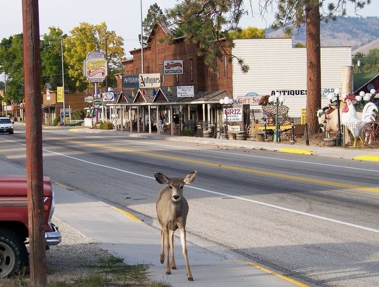
Darby montana area tour
Darby (Salish: snk̓ʷɫxʷexʷem̓i, "Place Where They Would Lift Something") is a town in Ravalli County, Montana, United States. The population was 720 at the 2010 census. Darby is located near the southwestern border of Montana and Idaho, along the Continental Divide.
Contents
- Darby montana area tour
- Map of Darby MT 59829 USA
- Darby montana antique store
- Geography
- Climate
- 2010 census
- 2000 census
- City Council
- Movies filmed in Darby
- References
Map of Darby, MT 59829, USA
Darby montana antique store
Geography
Darby is located at 46°1′19″N 114°10′47″W (46.022030, -114.179603).
According to the United States Census Bureau, the town has a total area of 0.58 square miles (1.50 km2), all of it land.
The area south of Darby is called nɫpapʔá in Salish.
Climate
This climatic region is typified by large seasonal temperature differences, with warm to hot (and often humid) summers and cold (sometimes severely cold) winters. According to the Köppen Climate Classification system, Darby has a humid continental climate, abbreviated "Dfb" on climate maps.
Visitors to Darby may wish to seek shelter during thunderstorms. In July 2012, "A cowboy and two spectators were taken by ambulance to a Hamilton hospital ... after lightning hit a power pole at the Elite Bull Connection, sending an electric shock through the grandstands, rodeo chutes and bull pens." On July 14, 2014, 45 cattle on a ranch near Darby were killed in a single lightning strike.
2010 census
As of the census of 2010, there were 720 people, 303 households, and 179 families residing in the town. The population density was 1,241.4 inhabitants per square mile (479.3/km2). There were 360 housing units at an average density of 620.7 per square mile (239.7/km2). The racial makeup of the town was 91.3% White, 0.1% African American, 4.2% Native American, 0.8% Asian, and 3.6% from two or more races. Hispanic or Latino of any race were 2.2% of the population.
There were 303 households of which 28.1% had children under the age of 18 living with them, 39.6% were married couples living together, 14.5% had a female householder with no husband present, 5.0% had a male householder with no wife present, and 40.9% were non-families. 33.3% of all households were made up of individuals and 12.9% had someone living alone who was 65 years of age or older. The average household size was 2.36 and the average family size was 2.94.
The median age in the town was 40.8 years. 24% of residents were under the age of 18; 8.2% were between the ages of 18 and 24; 23.1% were from 25 to 44; 29.6% were from 45 to 64; and 15% were 65 years of age or older. The gender makeup of the town was 49.9% male and 50.1% female.
2000 census
As of the census of 2000, there were 710 people, 279 households, and 176 families residing in the town. The population density was 1,336.5 people per square mile (517.2/km²). There were 316 housing units at an average density of 230.2/km² or 594.8/sq mi. The racial makeup of the town was 90.56% White, 0.14% African American, 3.24% Native American, 2.39% from other races, and 3.66% from two or more races. Hispanic or Latino of any race were 3.52% of the population.
There were 279 households out of which 36.9% had children under the age of 18 living with them, 41.9% were married couples living together, 14.0% had a female householder with no husband present, and 36.9% were non-families. 30.5% of all households were made up of individuals and 10.8% had someone living alone who was 65 years of age or older. The average household size was 2.54 and the average family size was 3.20.
In the town, the population was spread out with 32.3% under the age of 18, 9.0% from 18 to 24, 26.9% from 25 to 44, 22.5% from 45 to 64, and 9.3% who were 65 years of age or older. The median age was 33 years. For every 100 females there were 99.4 males. For every 100 females age 18 and over, there were 91.6 males.
The median income for a household in the town was $25,221, and the median income for a family was $27,500. Males had a median income of $21,071 versus $20,781 for females. The per capita income for the town was $11,658. About 19.5% of families and 24.0% of the population were below the poverty line, including 30.6% of those under age 18 and 9.3% of those age 65 or over.
City Council
The Darby Town Council has two wards and an at-large position.
Ward 1
Ward 2
At-large
Movies filmed in Darby
In 1989 the movie Disorganized Crime was filmed in Darby, Hamilton, and Missoula.