
Country Philippines Barangays ZIP code 2816 Local time Thursday 4:39 AM | District Lone District of Abra Time zone PST (UTC+8) Area 114.4 km² Province Abra | |
 | ||
Region Cordillera Administrative Region (CAR) Weather 21°C, Wind SE at 3 km/h, 76% Humidity | ||
Daguioman, officially the Municipality of Daguioman (Ilocano: Ili ti Daguioman, Filipino: Bayan ng Daguioman), is a municipality in the province of Abra in the Cordillera Administrative Region (CAR) of the Philippines. The population was 2,088 at the 2015 census. In the 2016 electoral roll, it had 1,291 registered voters.
Contents
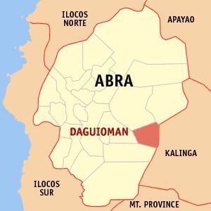
Map of Daguioman, Abra, Philippines
Geography
Daguioman is located at 17°28′N 120°56′E.
According to the Philippine Statistics Authority, the municipality has a land area of 114.37 square kilometres (44.16 sq mi) constituting 7000275000000000000♠2.75% of the 4,165.25-square-kilometre- (1,608.21 sq mi) total area of Abra.
Barangays
Daguioman is politically subdivided into 4 barangays.
Demographics
In the 2015 census, Daguioman had a population of 2,088. The population density was 18 inhabitants per square kilometre (47/sq mi). Daguioman is the home of the Banao tribe of Itneg.
In the 2016 electoral roll, it had 1,291 registered voters.