
Basin countries Australia | Ocean/sea sources South Pacific Ocean Ocean/sea source Pacific Ocean | |
 | ||
Etymology Vice-Admiral Bruni D'Entrecasteaux Settlements | ||
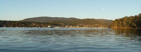
Sailing the d entrecasteaux channel tasmania
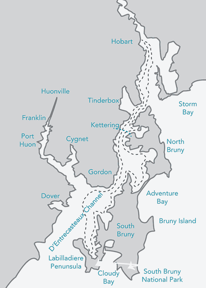
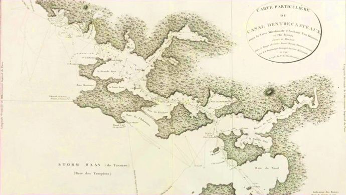
The D'Entrecasteaux Channel /ˌdɒntrəˈkæstoʊ/ is a body of water located between Bruny Island and the south-east of the mainland of Tasmania, Australia. The channel is the mouth for the estuaries of the Derwent and the Huon Rivers and empties into the Tasman Sea of the South Pacific Ocean. It was sighted by Abel Tasman in 1642 and surveyed in 1792 by Bruni d'Entrecasteaux.
Contents
- Sailing the d entrecasteaux channel tasmania
- Hartley ts21 yacht christina sailing the d entrecasteaux channel in tasmania
- History
- Geography and environment
- References
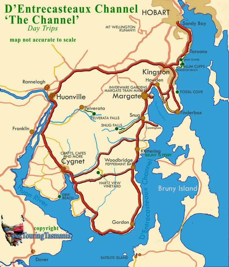
Towns on the D'Entrecasteaux Channel include Snug, Margate, Kettering, Woodbridge, Flowerpot, Middleton and Gordon.
Hartley ts21 yacht christina sailing the d entrecasteaux channel in tasmania
History
According to The Mercury newspaper, the channel "..... was discovered on April 20. 1792, by the celebrated French "Vice-Admiral Bruni D'Entrecasteaux, who, in the ships Recherche and Esperance, was searching for ill-fated La Perouse. Visiting Van Diemen's Land for the first time, he was attempting to find an anchorage in Adventure Bay, when, being himself ill in bed, the ships' navigators entered the channel to the west of Bruny Island, instead of going to the eastward of it. Thus, the discovery of the great channel was due to an accident. This is Labillardiere's account of the matter. A wrong bearing taken of the Mewstone accounts for the French navigator's error."
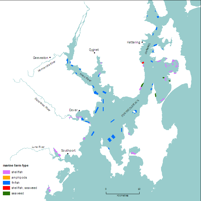
Geography and environment
The D'Entrecastaux Channel region sheltered by Bruny Island is increasingly affected by foreshore erosion, in some areas sandbagging aims to reduce the effects.
The channel is a breeding ground for scallops. Prior to 1969, fishing dredges were used to collect scallops from the seafloor. Damage caused by the dredging has led to collection by scuba divers.
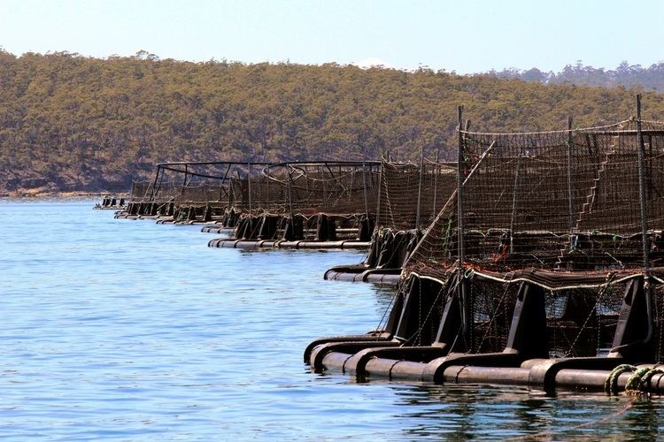
The D'Entrecasteaux Channel has become a popular location for keen photographers to capture images of the Aurora Australis with its numerous southern-facing water views and beaches, although light pollution from the numerous salmon farms is now starting to impact on this visual beauty from many locations.