
Type Highway | Length 169 km | |
 | ||
Route number(s) State Route 96
(Kingaroy - Nanango)
A3
(Nanango - Yarraman)
National Route A17
(Yarraman - Harlin)
State Route 85
(Harlin - Caboolture) Former
route number National Route 17
(Nanango - Yarraman) West end Bunya Highway (State Route 49), Kingaroy, Queensland East end Bruce Highway (State Highway M1), Caboolture, Queensland Major cities Kilcoy, Woodford, Nanango, Yarraman Via Nanango, Yarraman, Kilcoy, Woodford Major settlements Nanango, Yarraman, Kilcoy, Woodford | ||
Wyatt roy d aguilar highway
The D'Aguilar Highway is a two-lane highway linking the Bruce Highway near Caboolture with Kingaroy in the state of Queensland, Australia. Major towns along the route include Woodford, Kilcoy, Blackbutt, Yarraman, Nanango and Kingaroy. The highway is approximately 164 kilometres (102 mi) in length. The D'Aguilar Highway's highest elevation along its length is 527m just north of Yarraman, and the lowest point is at 26.8m just west of Caboolture.
Contents
- Wyatt roy d aguilar highway
- Map of DAguilar Hwy Queensland Australia
- State Route 85
- Proposed Kilcoy bypass
- Major Intersections
- References
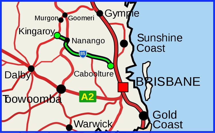
Map of D'Aguilar Hwy, Queensland, Australia
As of 13 December 2007, the D'Aguliar highway bypasses Caboolture to the north.
State Route 85
The section of this highway between Caboolture and Harlin is part of State Route 85, which extends for over 570 kilometres (354 mi) from Bribie Island to Nindigully, duplexing with the Brisbane Valley Highway (National Route A17) from Harlin to Esk, the New England Highway (State Route A3) from Hampton to Toowoomba, the Gore Highway (National Route A39) from Toowoomba to the Leichhardt Highway, and the southern 19 kilometres (12 mi) section of the Leichhardt Highway (National Route A39/State Route A5) to Goondiwindi.
Proposed Kilcoy bypass
In January 2009, the Department of Transport and Main Roads published details of the preferred design for a bypass of the Kilcoy township. The proposed route follows an abandoned rail corridor, and would have minimal impact on existing infrastructure.
Major Intersections
Intersections are listed from west to east.