
Country Czech Republic District Ústí nad Orlicí Time zone CET (UTC+1) Elevation 294 m Local time Thursday 1:14 AM | Region Pardubice Region Microregion Vysokomýtsko postal code 566 01 Area 6.59 km² | |
 | ||
Weather 6°C, Wind S at 16 km/h, 69% Humidity | ||
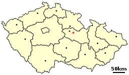
Džbánov is a small village in the Pardubice Region in the northeast of Bohemia, Czech Republic. It lies near the southern border of Ústí nad Orlicí District, close to Svitavy District, situated around 3 km to the southeast of Vysoké Mýto. The village is also called Džbánov u Vysokého Mýta (Džbánov by Vysoké Mýto).
Contents
Map of 566 01 D%C5%BEb%C3%A1nov, Czechia
The population of the village is about 310 inhabitants.
History
The village was founded at the end of the 13th century. In the 14th century Zbraslav monastery owned the village. After Hussite wars the village property was split to become a property of several placeholders (emperor, the town of Vysoké Mýto, nobility, etc.). The town of Vysoké Mýto owned the whole village between the end of the 16th century to 1850. Then the village became autonomous.
Name
The name of the village probably originates in personal name Čban. One of the first reeves or inhabitants was called that. Later the village was called Čbánov and then Džbánov.