
Population 2,677 (2011 census) Postcode(s) 2540 State electorate(s) South Coast Postal code 2540 Federal division Division of Gil | Established 1887 LGA(s) City of Shoalhaven Founded 1887 Local time Monday 9:38 PM | |
 | ||
Location 18 km (11 mi) ESE of Nowra Weather 21°C, Wind S at 34 km/h, 77% Humidity Points of interest The Beach House Culburra - Pet Friendly, Crookhaven Heads Light, Curleys Bay, Culburra Beach | ||
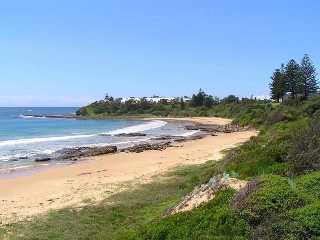
Culburra Beach, commonly referred to as Culburra, is a town located in the South Coast region of New South Wales, Australia. Located within the Shoalhaven local government area, the town is 18 kilometres (11 mi) east-southeast of Nowra. At the 2011 Census, the town had a population of 2,677 and is the regional centre for the coastal villages of Currarong, Callala Beach, Callala Bay and Orient Point.
Contents
Map of Culburra Beach NSW 2540, Australia
Description
Culburra is a small seaside town and a popular holiday, fishing and surfing location. Local industries include oysters, shrimp, and prawns. It has two surf beaches, Culburra Beach and Warrain Beach. The town is flanked by the Crookhaven River to the north and west, and Lake Wollumboola to the south. It is home to the Culburra Dolphins Rugby League team and the Culburra Cougars soccer team and the Culburra Beach Festival which happens annually on Mother's Day
The town also boasts the two closest surf beaches to Nowra and is home to the Culburra Beach and Nowra Surf Club whose clubhouse is located at the northern end of Warrain Beach. The beaches are patrolled during the summer holiday period, and being located on either side of Penguin Head face in different directions, providing a variety of surf conditions for board riders, swimmers, body surfers and families with young children. A wide variety of fish species are caught on these beaches and from the rocky headlands adjacent to them.
History
Originally called Wheelers Point after the first landholder George Wheeler; the name was changed to Culburra in 1916 after an Aboriginal word meaning "sand"; and later to Culburra Beach. Postal services were first provided from Warrain Beach Post Office, which was renamed Culburra Beach in 1970.
The area's first school was the Roseby Park Aboriginal School which opened in 1903. It became a public school in 1906 and remained that way until it closed in 1964. Culburra children had to attend Pyree Public School until its closure in August 1976, and the following month saw the opening of Culburra Public School.
Many people falsely believe that the modern street plan of Culburra Beach was designed by Walter Burley Griffin, who also designed the street plan for Canberra. There is no confirmed evidence that Walter Burley Griffin designed Culburra Beach. It is likely that someone else designed Culburra Beach in a similar style to Griffin. The above citations are poor and should not be regarded as actual evidence.
Culburra Beach is the location of the famous Max Dupain photo "The Sunbaker". Dupain took the photograph in 1937.[6] The man in the photograph was Harold Salvage (1905-1991), a British builder, who was part of a group of friends on a surfing trip.[4] The most familiar version of the photograph was not printed until a retrospective of Dupain's work in 1975.[4]