
Country Philippines Established 16 October 1953 Barangays Local time Monday 6:33 PM | District Lone district Municipality 16 January 1954 Area 73.42 km² Province Biliran | |
 | ||
Region Eastern Visayas (Region VIII) Weather 26°C, Wind N at 11 km/h, 88% Humidity Neighborhoods Bool East, Bool Central, Bool West, Tabojab | ||
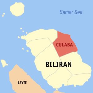
Culaba, officially the Municipality of Culaba (Waray: Bungto san Culaba; Cebuano: Lungsod sa Culaba; Filipino: Bayan ng Culaba), is a municipality in the province of Biliran in the Eastern Visayas (Region VIII) of the Philippines. The population was 12,325 at the 2015 census. In the 2016 electoral roll, it had 9,106 registered voters.
Contents
- Map of Culaba Biliran Philippines
- Geography
- Barangays
- Demographics
- Education
- Hospital and Health centers
- References
Map of Culaba, Biliran, Philippines
Geography
Culaba is located at 11°39′N 124°33′E.
According to the Philippine Statistics Authority, the municipality has a land area of 73.42 square kilometres (28.35 sq mi) constituting 7001137000000000000♠13.70% of the 536.01-square-kilometre- (206.95 sq mi) total area of Biliran.
Barangays
Culaba is politically subdivided into 17 barangays.
Demographics
In the 2015 census, Culaba had a population of 12,325. The population density was 170 inhabitants per square kilometre (440/sq mi).
In the 2016 electoral roll, it had 9,106 registered voters.