
Airport type Public Location Crystal, Minnesota 14L/32R 3,268 Code MIC Phone +1 763-537-4096 | Serves Minneapolis, Minnesota Elevation AMSL 869 ft / 265 m 3,268 995 Elevation 265 m | |
 | ||
Address 5800 Crystal Airport Rd, Minneapolis, MN 55429, USA Owner Metropolitan Airports Commission | ||
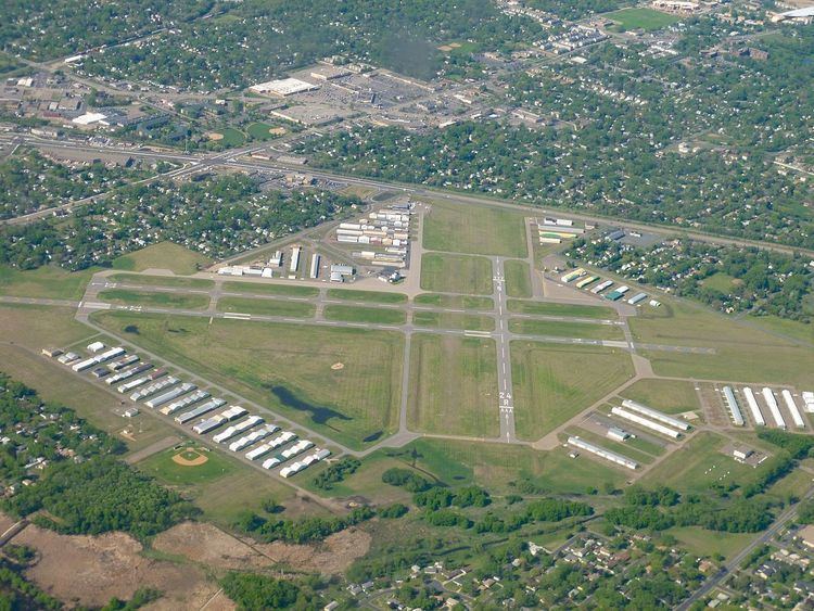
Crystal Airport (IATA: MIC, ICAO: KMIC, FAA LID: MIC) is a public airport named after the city of Crystal in Hennepin County, Minnesota, United States. Most of the airport is in the city of Crystal. Portions north of 62nd Avenue are in Brooklyn Park, and the north east corner of the airport is in Brooklyn Center. It is eight miles (13 km) northwest of the central business district of Minneapolis and is owned by the Metropolitan Airports Commission.
The airport opened in 1946 as a privately owned public use airport. In 1948 the Metropolitan Airports Commission purchased the airport. Additional land purchases were made in 1951 and 1954.
Facilities and aircraft
Crystal Airport covers an area of 436 acres (176 ha) which contains four runways:
For the 12-month period ending December 31, 2014, the airport had 42,351 aircraft operations, an average of 116 per day: 1% air taxi and 99% general aviation. In January 2017, there were 177 aircraft based at this airport: 159 single-engine, 11 multi-engine and 7 helicopter.