
GNIS feature ID 882889 | Area code 201 | |
 | ||
Croxton is a section of Jersey City in the New Jersey Meadowlands in Hudson County, New Jersey, United States.
Map of Croxton, Jersey City, NJ 07306, USA
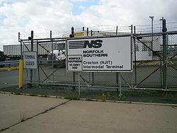
It is bounded by Secaucus at Penhorn Creek (named for the 17th century American colonial judge and President of the New Jersey Provincial Council and Commander-in-Chief of New Jersey, William Pinhorne ). The Riverbend of the Hackensack River and the Hudson Generating Station and the Marion Section lie to the south and Truck 1-9 and Western Slope to the east. Nearby North Bergen Yard and Croxton Yard are parts of the North Jersey Shared Assets Area. The Yard is officially known as the North Jersey Intermodal Terminal.
The area is informally named Croxton after Croxton Yard on the Norfolk Southern Freight Line. Much of the area is filled with New Jersey Transit commuter lines and freight lines. There are no passenger stations although Secaucus Junction is nearby. The area is home to the Metropolitan Bulk Mail Facility for New York and New Jersey. The only major road crossing the district is County Road, which connects Jersey City Heights with Secaucus. In 2005, the New Jersey Turnpike opened Exit 15X to allow access to the newly built Secaucus Junction train station, the access road to which acts like a huge U-turn, and dominates the landscape.
The name Croxton was given to the railroad yard after Philip Croxton, the traffic manager for Lorillard Tobacco Company, which had been located at 111 First Street in Downtown Jersey City.
New Jersey Transit bus route #2 travels along County Avenue from Secaucus Junction to Journal Square.