Designated 1971 Established 1938 | Area 124 ha | |
 | ||
Similar | ||
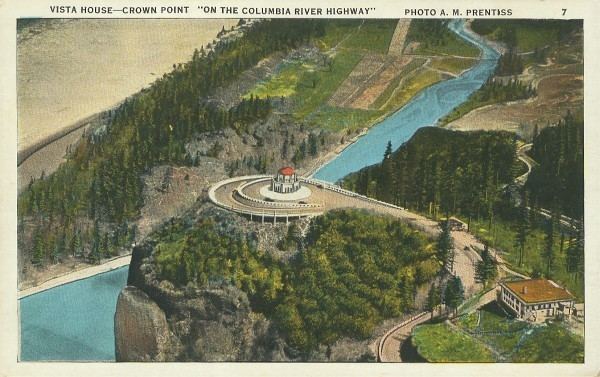
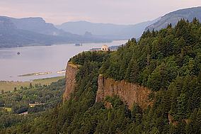
Crown Point (also known historically as Thor's Heights or Thor's Crown) is a basalt promontory on the Columbia River Gorge and an associated state park in the U.S. state of Oregon. It is located in eastern Multnomah County, approximately 15 miles (24 km) east of Portland. Crown Point is one of the scenic lookouts along the Historic Columbia River Highway, providing a panoramic view of part of the Columbia River. It stands 733 feet (223 m) above the river and is the remains of a lava flow that filled the ancestral channel of the Columbia River 14 to 17 million years ago. The Point was designated a National Natural Landmark in 1971.
Vista House
Vista House is an observatory at Crown Point that also serves as a memorial to Oregon pioneers and as a comfort station for travelers on the Historic Columbia River Highway. The site, on a rocky promontory, is 733 feet (223 m) above the Columbia River on the south side of the Columbia River Gorge. The building shows great sensitivity to its site in the Columbia River Gorge near Corbett, and is listed on the National Register of Historic Places.