
Population 992 (2011 census) Local time Sunday 7:43 PM Civil parish Evenley | OS grid reference SP544335 Post town BRACKLEY Dialling code 01869 | |
 | ||
Weather 5°C, Wind W at 16 km/h, 89% Humidity | ||
Croughton is a small village in the South Northamptonshire district of Northamptonshire, England. The population of the civil parish was 992 at the 2011 census. It is close to the border with Oxfordshire and Buckinghamshire and is six kilometres southwest of the town of Brackley. Along with Aynho it is one of the county's two southernmost villages.
Contents
Map of Croughton, Brackley, UK
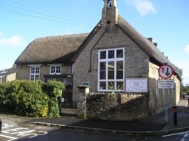
The village has a cooperative which is available for all daily essentials, only closing on Christmas Day, Boxing Day and New Year's Day, as well as being the home of Croughton All Saints Primary School.
Name
There is no one predominant pronunciation of the village's name; residents pronounce its first syllable to rhyme either with "thou" or with "crow". The "thou" pronunciation was adopted by the Americans nearby at RAF Croughton when the airbase was in use by the USAF. In early records the name has spellings such as Crewelton, and is thought to mean "town in the fork of a river".
Location
Croughton is situated upon the B4031 road running west from Buckingham, and is close to the Ockley Brook, a minor tributary of the River Cherwell, which it meets southwest of Aynho.
The village is dwarfed by RAF Croughton, a base on long-term lease to the United States Air Force, 2 miles (3.2 km) south-east.
History
The village is best known for its Parish Church dedicated to All Saints, which is of historical significance for its murals, now sadly damaged. An historic elm reputedly stood in the church grounds for 800 years, and although it is believed to have died of Dutch elm disease in the 1970s, its demise dates back to the early 1900s. The remains of an Iron Age fort, Rainsborough Camp, lie to the north-west of the village, and the site of the long-abandoned mediaeval village of Astwick lies to the north-east.