
OS grid reference SK284464 Post town BELPER | Sovereign state United Kingdom Postcode district DE56 | |
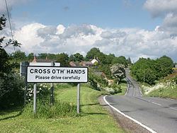 | ||
Cross o' th' Hands is a small area of settlement in Derbyshire, England. It is located 10 miles (16 km) north-west of Derby on the A517 road between Hulland and Turnditch.
Map of Cross o'th'hands, Belper, UK
The settlement is named after its original public house. The public house was near a gravel pit that was used for staging bare-knuckle fist fights, and was probably itself named after the sport.
Despite the settlement's small size, it is well connected via public transport, served by two Arriva buses: the 109 and the 'one' service between Derby and Ashbourne [1].
Cross o' th' Hands' single through road, Intakes Lane, joins with the A517 at the top of the hill, becoming Hillcliff Lane and joining up with the B5023 Wirksworth Road. The top of Hillcliff Lane commands a spectacular view across the open greenlands of Amber Valley.