
Population 16,800 Sovereign state United Kingdom Ceremonial county South Yorkshire | Country England District Sheffield UK parliament constituency Sheffield Hallam | |
 | ||
Region Yorkshire and the Humber EU Parliament Yorkshire and the Humber Councillors Sheffield City Council
Anne Murphy (Labour Party)
Geoff Smith (Labour Party)
Rob Frost (Liberal Democrats) | ||
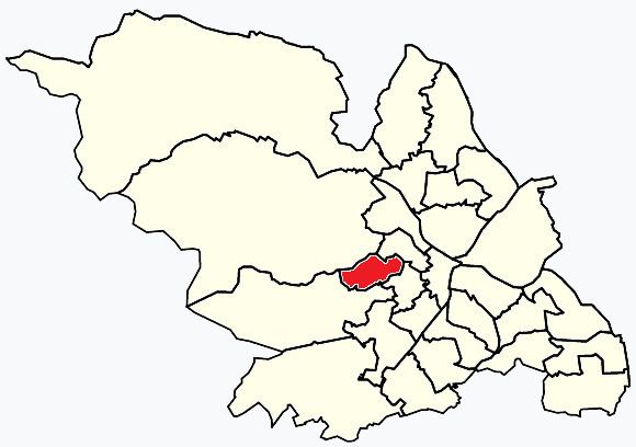
Crookes & Crosspool ward—which includes the districts of Crookes, Steelbank, Crosspool, and Sandygate —is one of the 28 electoral wards in City of Sheffield, England. It is located in the western part of the city and covers an area of 3.9 km2. The population of this ward in 2011 was 17,700 people in 7,266 households.
Contents
Map of Crookes, Sheffield, UK
The current councillors for Crookes Ward are Labour's Geoff Smith, Labour's Anne Murphy, and Liberal Democrat's Rob Frost. In the 2004 local elections Sylvia Anginotti, John Hesketh, and Brian Holmes, all Liberal Democrats, were returned as councillors for the newly drawn ward. John Hesketh was defeated by Labour's Geoff Smith in 2011. Crookes ward is located within Sheffield Hallam Parliamentary constituency. The local MP is Nick Clegg who was leader of the Liberal Democrat Party and Deputy Prime Minister until the general election of May 2015.
Crookes
Crookes (grid reference SK328877) is a suburb of the City of Sheffield, England, about 1.6 miles (2.6 km) west of the city centre. It borders Broomhill to the south, Walkley and Crookesmoor to the east and open countryside around the River Rivelin to the north. It is home to a large student population from the nearby University of Sheffield, and also contains the university's Tapton Hall of Residence
Steel Bank
An area of terraced housing in Crookes, Sheffield. Steel Bank is a steep hill that starts from Springvale Road to the South and Northfield Road to the North. It stretches from Western Road to Heavygate Road which borders on the S6 postcode and the Walkley council ward. Roads on Steel Bank are Western Road, Brighton Terrace Road, Melbourn Road, Mona Road, and the very steep Townend Street and Bates Street. Slinn Street sits at the top of Steel Bank. Aldred Road and Bradley Street are also part of the Steel Bank area of Crookes. The name 'Steel Bank' is rarely used, and most would just called the area 'Crookes'. Steel Bank has one pub named 'The Princess Royal'. This is an old local pub situated on Slinn Street.
Sandygate
Sandygate (grid reference SK310867) is a residential area on the western tip of Sheffield. It is home to the oldest football ground in the world, Sandygate Road, which has been home to Hallam C.C since 1804 and Hallam F.C. since 1860. Hallamshire Golf Course is also located in the area.
Crosspool
Crosspool is a residential area on the western outskirts of Sheffield. It contains four large schools, Lydgate Junior School, Lydgate Infant School, Tapton School, and King Edward VII Lower School.