
Country Brazil State Goiás Time zone BRT/BRST (UTC-3/-2) | Region Central-West Region Elevation 389 m (1,276 ft) Area 4,661 km² | |
 | ||
Microregion São Miguel do Araguaia Microregion | ||
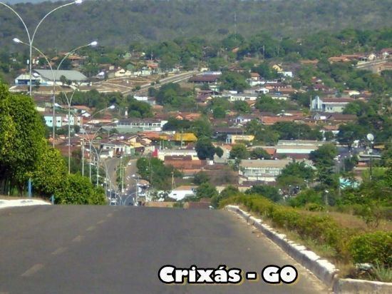
Crixás is a municipality in northwestern Goiás state, Brazil. The population was 14,547 (2007) in a total area of 4,661.5 km². Crixás was a major gold producing area but is now gradually losing population.
Map of Crix%C3%A1s - State of Goi%C3%A1s, Brazil
Crixás is 334 kilometers from the state capital, Goiânia, and is in the São Miguel do Araguaia Microregion. Connections from Goiânia are made by GO-080 / Nerópolis / São Francisco de Goiás / BR-153 / Jaraguá / Rialma / GO-336 / Itapaci / GO-154 / Pilar de Goiás / Santa Terezinha de Goiás / GO-347.
The population growth rate from 1996/2007 was -0.87.%. In 2007 the urban population was 11,516 and the rural population was 3,031.
The history of Crixás begins in the eighteenth century with the discovery of gold. The first explorer in these lands was Manoel Rodrigues Tomar, who arrived in 1726. At the time the region was inhabited by the Crixás Indians. The name of the city comes from these Indians. In 1740 the settlement became Arraial de Crixás. In 1935 it became Vila de Crixás, and in 1953 it became a city.
The economy is based on mineral mining and milk production. The municipality has a gold mine, the Serra Grande Gold Mine, partly owned and operated by AngloGold Ashanti, the third-largest gold mining company in the world, and the Kinross Gold Corporation. There is also production of manganese and talcum. In 2007 there were 9 industrial units and 104 retail units. There were three banks and one dairy.
In education the area had 12 schools and 3,546 students. There is also a campus of the Universidade Estadual de Goiás, or UEG, with courses in Pedagogy, Letters, Geography, History, and Mathematics. There was one small hospital, with 32 beds, and 07 public health clinics.
The ranking on the 2000 Municipal Human Development Index was 0.717. On the Seplan Economic Development Index (2001) the ranking was 21 out of 246 municipalities (2001). See Seplan. On the Seplan Social Development Index (2000) the ranking was 133 out of 246 municipalities (2000) See Seplan