
- left Cigher - location near Gyula Source Apuseni Mountains Cities Brad, Békés | - location Apuseni Mountains Length 236 km Mouth Körös Countries Romania, Hungary | |
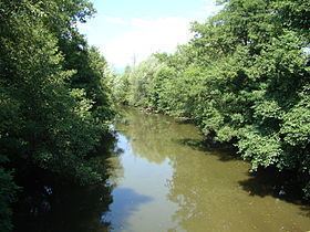 | ||
The Crișul Alb (Romanian), (Hungarian: Fehér-Körös) is a river in western Romania in the historical region of Transylvania and south-eastern Hungary (Békés County). Its source is in the southern Apuseni Mountains (Romanian: Munții Apuseni). It flows through the towns Brad, Ineu, Chișineu-Criș in Romania, and Gyula in Hungary. Crossing the border of Hungary, the river, now called Fehér-Körös, joins the Fekete-Körös a few kilometres north from Gyula to form the Körös River.
Contents
Map of Cri%C8%99ul Alb River
Towns and villagesEdit
The following towns and villages are situated along the river Crișul Alb, from source to mouth. In Romania: Brad, Baia de Criș, Hălmagiu, Gurahonț, Dieci, Sebiș, Bocsig, Ineu, Șicula, Chișineu-Criș
In Hungary: Gyula, Doboz
TributariesEdit
The following rivers are tributaries to the river Crișul Alb:
The Canalul Morilor, an irrigation canal, runs parallel to the Crișul Alb through the lowland area between Buteni and Pilu.