
Country United States FIPS code 48-17504 Elevation 129 m Zip code 75114 Local time Tuesday 5:08 PM | State Texas Time zone Central (CST) (UTC-6) GNIS feature ID 1333620 Area 7.3 km² Population 3,043 (2013) Area code 972 | |
 | ||
Weather 19°C, Wind N at 16 km/h, 18% Humidity | ||
How to say or pronounce usa cities crandall texas
Crandall is a city in Kaufman County, Texas, United States. The population was 2,858 at the 2010 census.
Contents
- How to say or pronounce usa cities crandall texas
- Map of Crandall TX 75114 USA
- Geography
- Demographics
- Education
- Climate
- Popular Culture
- References
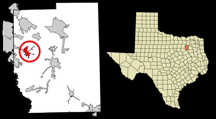
Map of Crandall, TX 75114, USA
Geography
Crandall is located at 32°37′39″N 96°27′12″W (32.627407, -96.453276).
According to the United States Census Bureau, the city has a total area of 2.8 square miles (7.3 km2), all land.
Demographics
As of the census of 2000, there were 2,774 people, 881 households, and 740 families residing in the city. The population density was 976.4 people per square mile (377.1/km²). There were 914 housing units at an average density of 321.7 per square mile (124.3/km²). The racial makeup of the city was 89.40% White, 3.82% African American, 0.61% Native American, 0.18% Asian, 4.58% from other races, and 1.41% from two or more races. Hispanic or Latino of any race were 7.21% of the population.
There were 881 households out of which 54.7% had children under the age of 18 living with them, 67.9% were married couples living together, 12.7% had a female householder with no husband present, and 15.9% were non-families. 13.4% of all households were made up of individuals and 5.6% had someone living alone who was 65 years of age or older. The average household size was 3.15 and the average family size was 3.44.
In the city, the population was spread out with 34.8% under the age of 18, 8.4% from 18 to 24, 32.6% from 25 to 44, 17.9% from 45 to 64, and 6.3% who were 65 years of age or older. The median age was 31 years. For every 100 females there were 97.6 males. For every 100 females age 18 and over, there were 90.9 males.
The median income for a household in the city was $56,033, and the median income for a family was $61,250. Males had a median income of $37,969 versus $31,078 for females. The per capita income for the city was $20,381. About 1.9% of families and 2.9% of the population were below the poverty line, including 1.9% of those under age 18 and 8.5% of those age 65 or over.
Education
The city is served by the Crandall Independent School District. The district's schools include W A Martin Elementary School, Nola Kathryn Wilson Elementary School, Barbara Walker Elementary School, Crandall Middle School, and Crandall High School. You can visit CISD on the web at http://www.crandall-isd.net.
W A Martin Elementary is east of the city of Crandall in unincorporated Kaufman County. Walker Elementary is located in the Heartland subdivision off I-20 at FM 741. Wilson Elementary and Crandall Middle are within the city of Crandall. Crandall High is partially in Crandall and partially in unincorporated Kaufman County, although adjacent to the Elementary and Middle schools.
Climate
The climate in this area is characterized by hot, humid summers and generally mild to cool winters. According to the Köppen Climate Classification system, Crandall has a humid subtropical climate, abbreviated "Cfa" on climate maps.
Popular Culture
Bonnie and Clyde and Boys Don't Cry each filmed scenes in Crandall, while the episode "1800 Days to Justice" of Route 66 was filmed completely in Crandall, but takes place in the fictional town of Harcourt Juncture.