
Area 2.8 km² | Population Uninhabited | |
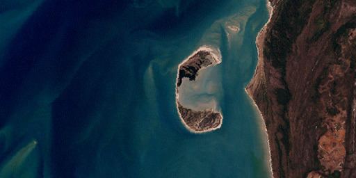 | ||
Crab Island, called Moent Island in the native language, is an uninhabited island west of Muttee Heads and the coastal community of Seisia which is adjacent to Bamaga at the tip of Cape York Peninsula within the Endeavour Strait in the Gulf of Carpentaria in Queensland, Australia. It is around 280 hectares (690 acres). The distance to the closest mainland (close to Slade Point) is 1.4 kilometres (0.87 mi).
Map of Crab Island, Queensland, Australia
Crab Island lies between Australia and the Melanesian island of New Guinea in the southwestern part of the Torres Strait, facing the Arafura Sea to the west. It is the most significant breeding ground of the Flatback Turtle Chelonia depressa and occasional nesting by Eretmochelys imbricata and Lepidochelys olivacea.
This island is south of the Torres Strait Islands.