
Type reservoir Basin countries United States Surface elevation 236 m Length 6 km | Primary inflows Catchment area 119.8 sq mi (310 km) Max. length 3.5 mi (6 km) Area 257 ha Width 800 m Inflow source Coyote Creek | |
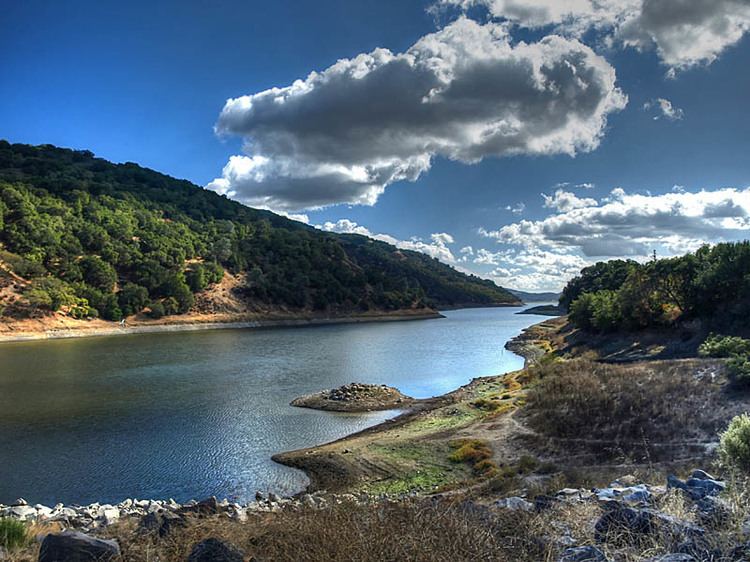 | ||
Coyote Lake (also known as Coyote Reservoir) is an artificial lake in Santa Clara County, California, north of Gilroy.
Map of Coyote Lake, California, USA
The lake is impounded by Coyote Dam, a 140-foot (43 m) high, 980-foot (300 m) long, earth and rock dam built in 1936. It holds 23,244 acre feet (28,671,009 m3) of water when full. The Santa Clara Valley Water District owns the dam.
A 4,595-acre county park ("Coyote-Bear") surrounds the reservoir, and provides camping (RVs and tents), fishing ("catch-and-release"), picnicking, and hiking activities. Power boating, jetskiing, waterskiing, sailing, canoeing/kayaking and fishing are all allowed in the reservoir. Swimming is not allowed by order of the Santa Clara Valley Water District. The boat launch ramp is located two miles north of the visitor center. It has two docks, a 3-lane concrete ramp, paved parking and a restroom. For fisherman, the lake contains bluegill, black crappie, channel catfish, carp and black bass. The lake is closed to all boating between mid-October and mid-April.