
Postcode(s) 2663 Local time Wednesday 4:34 AM | Postal code 2663 | |
 | ||
Location 504 km (313 mi) SW of Sydney74 km (46 mi) NW of Wagga Wagga34 km (21 mi) NW of Coolamon Weather 16°C, Wind E at 23 km/h, 58% Humidity | ||
Cowabbie is a rural community in the central part of the Riverina region of New South Wales, Australia. It is situated by road about 29 kilometres (18 mi) south from Ardlethan and 32 kilometres (20 mi) north from Matong along the Wagga Wagga road.
Map of Cowabbie NSW 2652, Australia
The place name Cowabbie is derived from expression used by the local Aboriginals for cows when they were first seen in the area by these early inhabitants, and Cowabbie Station is one of the functioning properties in the area.
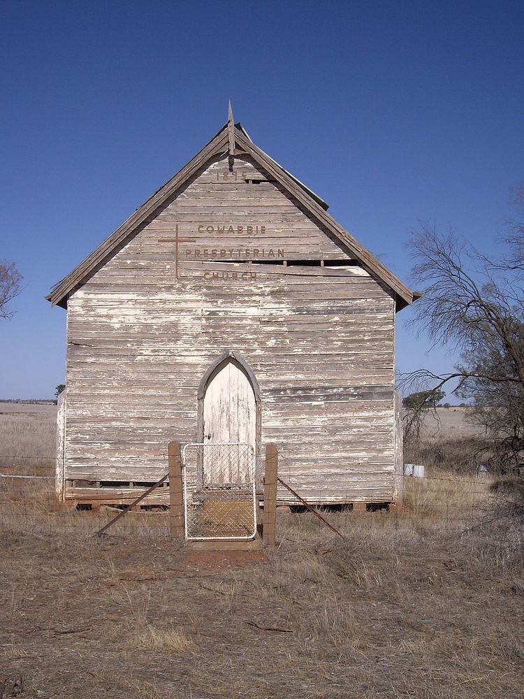
Cowabbie has a rich Presbyterian history. The original church - dilapidated but memorialised by the small community surrounding it, was first built by the local Hannah family in 1865 and then transported to its current location by bullock-team in 1926.
References
Cowabbie Wikipedia(Text) CC BY-SA