
Country East Timor Time zone UTC+9 Area 1,203 km² Capital Suai, East Timor | Area rank 7th ISO 3166 code TL-CO Population 64,550 (2015) | |
 | ||
Subdistricts Fatululic, Fatumean, Fohorem, Zumalai, Maucatar, Suai, Tilomar | ||
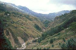
Cova Lima is a district of East Timor, in the Southwest part of the country. It has a population of 59,455 (Census 2010) and an area of 1,230 km². The capital of the district is Suai, which lies 136 km from Dili, the national capital. The subdistricts of Cova Lima are Fatululic, Fatumean, Fohorem, Zumalai, Maucatar, Suai, and Tilomar.
Map of Cova-Lima, Timor-Leste
Cova Lima borders the Timor Sea to the south, the districts Bobonaro to the north, Ainaro to the east, and the Indonesian province Nusa Tenggara Timur to the west.
References
Cova Lima District Wikipedia(Text) CC BY-SA