Area codes 071 Local time Tuesday 2:01 PM Area code 071 | Postal codes 6180-6183 Website www.courcelles.be Province Hainaut | |
 | ||
Weather 9°C, Wind W at 14 km/h, 68% Humidity Governing parties Mouvement Réformateur, Centre démocrate humaniste, Ecolo | ||
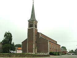
Courcelles ([kuʁ.sɛl]) is a Walloon municipality located in the Belgian province of Hainaut. As of January 1, 2006, Courcelles had a total population of 29,626. The total area is 44.24 km² which gives a population density of 670 inhabitants per km².
Map of Courcelles, Belgium
The municipality consists of the following sub-municipalities: Courcelles proper, Gouy-lez-Piéton, Souvret, and Trazegnies.
In 1944, the town was the site of the Courcelles Massacre of 20 civilians by Belgian collaborators. The event is commemorated by a plaque at the site.
References
Courcelles, Belgium Wikipedia(Text) CC BY-SA
