
State New York Borough Bronx Area code 718, 347, 646 Population 3,548 (2011) | ZIP codes 10465 Area 54 ha | |
 | ||
Restaurants Loretta's Pizza, Country Bay Pizza, Vibano's Restaurant, Tutto Bravo, Nonna's | ||
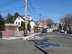
Country Club is mixed-income, mostly upper middle class to affluent residential neighborhood located in the East Bronx in New York City; it shares the 10465 ZIP code with Throggs Neck. Country Club is east of Pelham Bay; and it contains a large Italian-American population.
Contents
Map of Country Club, Bronx, NY, USA
The neighborhood's boundaries are Spencer Avenue to the north, Eastchester Bay to the east, Layton Avenue to the south, and New England Thruway to the west. This area is policed by the 45th Precinct of the New York City Police Department. Pelham Bay Park (including Orchard Beach), the largest public park in New York City, is located just north of Country Club, which itself is approximately two miles from City Island in Eastchester Bay.
Transportation
Since there are no alternate side parking regulations in this residential area, many residents drive. There are two New York City Subway stations relatively nearby: Pelham Bay Park and Buhre Avenue, both on the 6 <6> trains. Surface transportation is provided by the Bx24 local bus.
Education
Country Club has a private primary educational institution within its borders, Villa Maria Academy, operated by the Congregation of Notre Dame of Montreal. The zoned public school, PS 71, is in nearby Pelham Bay in the New York City Department of Education's District 8.
Demographics
Country Club has a population of around 3,548 people. It is a predominantly white neighborhood with around 89% of the population of Country Club being non-Hispanic white, while approximately 8% are of Hispanic ancestry and the remaining 3% a mix of Black and Asian.