
Country United States Area code(s) 539/918 Elevation 201 m Zip code 74428 Local time Tuesday 12:11 AM | Time zone Central (CST) (UTC-6) FIPS code 40-17550 Area 80 ha Population 157 (2013) | |
 | ||
Weather 16°C, Wind W at 32 km/h, 79% Humidity | ||
Council Hill is a town in Muskogee County, Oklahoma, United States. The population was 158 at the 2010 census, an increase of 28.5 percent from 129 at the 2000 census.
Contents
Map of Council Hill, OK 74450, USA
History
Council Hill began as a council house for the Creek Nation about 1840, after the tribe had been forced to emigrate to Indian Territory. The Creeks named this location as Weklwa Hulwe or "High Spring," and consider it their first capital. Smoke signals from the top of the hill announced calls for general council meetings to other Creek towns in the vicinity. After the outbreak of the American Civil War, this place became the headquarters of the Creek Regiment of the Confederate Army, led by D. N. McIntosh.
After the Civil War, Council Hill became a simple farm community. The first post office was established in 1905. The Missouri, Oklahoma and Gulf Railroad (later Kansas, Oklahoma and Gulf Railroad) opened a line through the town in 1907 that enabled shipment of livestock and farm products to markets in the north and east. Cotton was the main crop, but other products included corn, potatoes, wheat, and oats. Oklahoma Pipeline Company built a pumping station at Council Hill for its line that carried crude oil from Glenn Pool to the Gulf Coast.
Geography
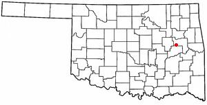
Council Hill is located at 35°33′19″N 95°39′7″W (35.555141, -95.652076). It is 25 miles (40 km) south of Muskogee on U. S. Highway 72.
According to the United States Census Bureau, the town has a total area of 0.3 square miles (0.78 km2), all of it land.
Demographics
As of the census of 2000, there were 129 people, 48 households, and 36 families residing in the town. The population density was 408.6 people per square mile (155.6/km²). There were 52 housing units at an average density of 164.7 per square mile (62.7/km²). The racial makeup of the town was 79.07% White, 2.33% African American, 12.40% Native American, and 6.20% from two or more races.
There were 48 households out of which 20.8% had children under the age of 18 living with them, 64.6% were married couples living together, 10.4% had a female householder with no husband present, and 25.0% were non-families. 25.0% of all households were made up of individuals and 10.4% had someone living alone who was 65 years of age or older. The average household size was 2.69 and the average family size was 3.22.
In the town, the population was spread out with 29.5% under the age of 18, 6.2% from 18 to 24, 20.9% from 25 to 44, 20.2% from 45 to 64, and 23.3% who were 65 years of age or older. The median age was 40 years. For every 100 females there were 111.5 males. For every 100 females age 18 and over, there were 97.8 males.
The median income for a household in the town was $20,500, and the median income for a family was $21,875. Males had a median income of $37,917 versus $37,500 for females. The per capita income for the town was $9,018. There were 20.5% of families and 30.1% of the population living below the poverty line, including 47.1% of under eighteens and 35.1% of those over 64.