
Country United States Area code(s) 701 Elevation 437 m Population 933 (2013) | Time zone Central (CST) (UTC-6) FIPS code 38-15900 Zip code 58425 Local time Sunday 5:43 PM | |
 | ||
Weather 6°C, Wind SE at 14 km/h, 84% Humidity | ||
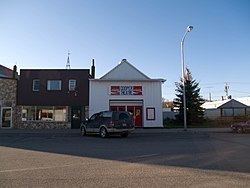
Cooperstown is a city in Griggs County, North Dakota, United States. It is the county seat of Griggs County. The population was 984 at the 2010 census. Cooperstown was founded in 1882.
Contents
- Map of Cooperstown ND 58425 USA
- History
- Geography and climate
- 2010 census
- 2000 census
- Notable people
- References
Map of Cooperstown, ND 58425, USA
History
Cooperstown was laid out in 1882, soon before the railroad was extended to that point. The Griggs County Courthouse was built in 1884.
Geography and climate
Cooperstown is located at 47°26.7′N 98°7.4′W (47.4452, -98.1229).
According to the United States Census Bureau, the city has a total area of 0.97 square miles (2.51 km2), all of it land.
2010 census
As of the census of 2010, there were 984 people, 477 households, and 254 families residing in the city. The population density was 1,014.4 inhabitants per square mile (391.7/km2). There were 543 housing units at an average density of 559.8 per square mile (216.1/km2). The racial makeup of the city was 99.2% White, 0.2% African American, 0.1% Native American, 0.4% Asian, and 0.1% from other races. Hispanic or Latino of any race were 0.3% of the population.
There were 477 households of which 21.0% had children under the age of 18 living with them, 44.2% were married couples living together, 4.8% had a female householder with no husband present, 4.2% had a male householder with no wife present, and 46.8% were non-families. 44.2% of all households were made up of individuals and 24.1% had someone living alone who was 65 years of age or older. The average household size was 1.96 and the average family size was 2.69.
The median age in the city was 52.3 years. 19.9% of residents were under the age of 18; 3.8% were between the ages of 18 and 24; 18.1% were from 25 to 44; 28.4% were from 45 to 64; and 29.9% were 65 years of age or older. The gender makeup of the city was 47.0% male and 53.0% female.
2000 census
As of the census of 2000, there were 1,053 people, 489 households, and 270 families residing in the city. The population density was 1,128.2 people per square mile (437.2/km²). There were 563 housing units at an average density of 603.2 per square mile (233.7/km²). The racial makeup of the city was 98.86% White, 0.19% Native American, 0.28% Asian, 0.38% from other races, and 0.28% from two or more races. Hispanic or Latino of any race were 0.95% of the population.
There were 489 households out of which 22.9% had children under the age of 18 living with them, 48.3% were married couples living together, 5.7% had a female householder with no husband present, and 44.6% were non-families. 42.3% of all households were made up of individuals and 26.0% had someone living alone who was 65 years of age or older. The average household size was 2.04 and the average family size was 2.79.
In the city, the population was spread out with 20.0% under the age of 18, 4.7% from 18 to 24, 20.3% from 25 to 44, 22.9% from 45 to 64, and 32.1% who were 65 years of age or older. The median age was 48 years. For every 100 females there were 84.7 males. For every 100 females age 18 and over, there were 83.8 males.
The median income for a household in the city was $28,705, and the median income for a family was $41,307. Males had a median income of $26,688 versus $17,083 for females. The per capita income for the city was $17,334. About 5.5% of families and 10.5% of the population were below the poverty line, including 11.7% of those under age 18 and 11.2% of those age 65 or over.