
Country Philippines Founded
Reestablished 1871
1920 Highest elevation 500 m (1,600 ft) Local time Sunday 10:47 AM | District 6th District of Cebu Barangay Area 37.03 km² Province Cebu | |
 | ||
Region Central Visayas (Region VII) Weather 27°C, Wind N at 26 km/h, 63% Humidity Neighborhoods Garden Bloom Acres, Tugbongan, Tilhaong, Nangka, Polog, Poblacion Oriental | ||
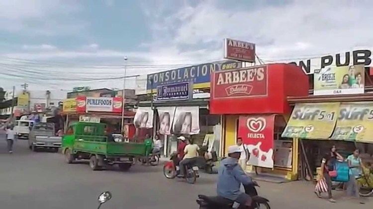
Consolacion is a 1st municipal income class municipality in the province of Cebu, Philippines. It is about 12 1⁄2 kilometres (7.8 mi) from Cebu City, within Metro Cebu, and stretches some 15 kilometres (9.3 mi) from north to south with 5 kilometres (3.1 mi) at its widest. Consolacion is bounded on the north by Liloan, Cebu, on the south by the city of Mandaue, on the west by the Mactan Channel and on the east by the city of Cebu. According to the 2015 census, it has a population of 131,528. In the 2016 electoral roll, it had 73,893 registered voters.
Contents
- Map of Consolacion Cebu Philippines
- History
- Geography
- Barangays
- Demographics
- Economy
- Infrastructure
- Utilities
- Transportation
- Education
- Sarok Festival
- Notable people
- References
Map of Consolacion, Cebu, Philippines
History
Consolacion was a component barangay first founded in 1871 with a population of 14,248. Before this, it was only a barrio of the municipality of Mandaue. Consolacion became a separate town in 1871. However, in 1902 and 1903, unable to maintain its status as an independent municipality, it reverted to Mandaue.
In 1920, Consolacion was again made an independent municipality after a petition was accepted by the governor. So grateful were the townspeople to the Spanish governor that they named their new town after his daughter – Consolacion – and they also chose San Narciso as their patron saint, the namesake of the governor's wife, Narcisa.
A year after the construction of the Casa Real or municipal hall, the people built their first church. Because it was made of wood, nipa, and bamboo, it was totally destroyed by a typhoon in 1888. A second one was also destroyed by a typhoon in 1892. A third one was built just before World War II, on its current site.
The present municipal hall is already the third one. The first was destroyed by the typhoon of 1892. The second one was also destroyed, by the Japanese during World War II. Today, Consolacion is a robust residential urban municipality with a vigorous economy, providing a place to live for people employed in the neighbouring cities of Mandaue, Lapu-Lapu and Cebu.
Geography
70% of the total area of the town is above or highland mountains and 18% foreshore land. The contours are irregular and the highest point is about 500 metres (1,600 ft) above sea level.
Barangays
Consolacion comprises 21 barangays over its 37 km2 (14.3 sq mi):
Demographics
The population of Consolacion is fast-growing with an intercensal growth rate of 50.45% from 1980 to 1990, repeated and more in subsequent decades.
In the 2016 electoral roll, it had 73,893 registered voters, meaning that 56% of the population are aged 18 and over.
The demographic distribution profile of Consolacion shows sparsely populated upland barangays, and densely populated lowland barangays within the commercial area along the existing national highway.
Economy
Consolacion's recent economic trend is towards the development of operation of housing/subdivision facilities even with the presence of several medium size manufacturing industries. Consolacion is predicted to become a residential urban municipality in the next 5–10 years.
Infrastructure
Utilities
Transportation
The main transportation used to get into the town is the jeepney.
The most popular transportation getting around the town is by motorcycle, locally called "habal-habal".
Because of its location on the National Highway, there are many long-distance buses to all northern Cebu, both eastern and western.
Education
Sarok Festival
The Sarok Festival is celebrated on Consolacion's foundation day. Sarok is a hat made of bamboo strips and dried banana leaves. Sarok Festival a mardigras of colors and street dancing along the main road of Consolacion is celebrated every 14 February in commemoration of Consolacion founding anniversary. The main attraction of this festival is the colorful Sarok and its wide uses.
To protect farmers and the folks from the sun and the rain, the sarok, a conical hat made from bamboo strips and dried banana leaves, becomes the needed fad for the people of Consolacion especially that the town is an agricultural land. The festival was traditionally celebrated every 14 February to coincide with its charter day celebrations but this now celebrated in October. However, the Sarok Festival evolved into a free interpretation dance, with the musical concept inspired from the Miligoy de Cebu, a published Filipino folk dance originating from the same place.
Consolacion is one of the contributor in Cultural History. It had created a dance called "Miligoy de Cebu". This dance is usually performed by pairs of dancers during social gatherings like baptism, weddings, and special programs in the poblacion. Dancers hold a pair of bamboo castanets in each hand.