
Population 766 (2006 census) Local time Sunday 9:44 AM | Postcode(s) 4552 Postal code 4552 | |
 | ||
Weather 28°C, Wind N at 6 km/h, 68% Humidity Points of interest Booloumba Creek Day Use Area, Booloumba Falls, Mount Allan | ||
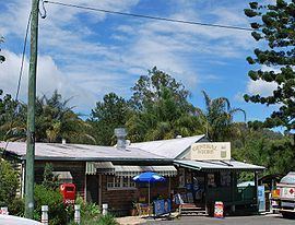
Conondale is a town in the Sunshine Coast, Queensland hinterland region of Queensland, Australia. The town is located in the Sunshine Coast Region local government area and on the banks of the upper Mary River, 114 kilometres (71 mi) north of the state capital, Brisbane. At the 2006 census, Conondale and the surrounding area had a population of 766.
Contents
Map of Conondale QLD 4552, Australia
Crystal Waters ecovillage
Conondale is home to the Crystal Waters ecovillage which provides accommodation for 200 residents. It was established formally in 1987 making it one of the first in Australia.
Heritage listings
Conondale has a number of heritage-listed sites, including:
History
Conondale Post Office opened by 1949 (a receiving office or Telegraph office had been open from 1904) and closed in 1974.
References
Conondale, Queensland Wikipedia(Text) CC BY-SA