
OS grid reference SD981675 Sovereign state United Kingdom Postcode district BD23 Dialling code 01756 | Post town SKIPTON Local time Saturday 8:16 PM District Craven | |
 | ||
Weather 6°C, Wind S at 18 km/h, 89% Humidity | ||
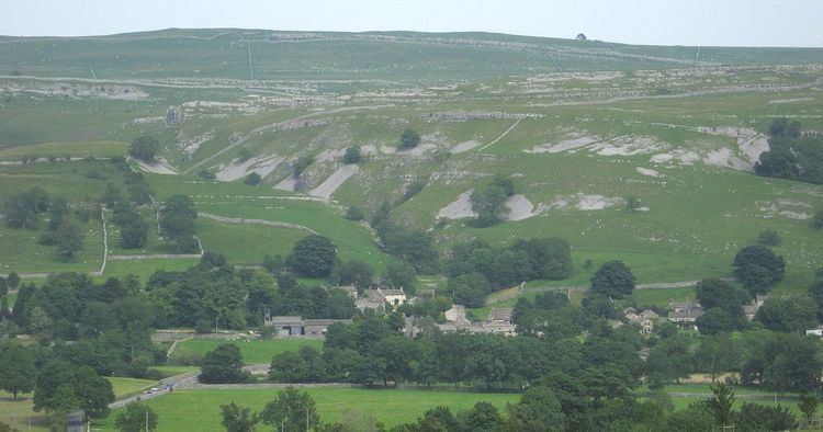
Conistone is a small village (population 117 in the 2001 census) in North Yorkshire, England. It lies 3 miles north of Grassington, beside the River Wharfe, in Upper Wharfedale.
Map of Conistone, Skipton, UK
The village is set in characteristic limestone scenery, including Mossdale Caverns, the dry gorge of Conistone Dib and the limestone outcrop of Conistone Pie. Above the Dib the Dales Way path connects Kettlewell, to its north, and Grassington, to its south, providing distant views over Wharfedale. From the B6160 road, the Wharfe is crossed at Conistone by a stone-arch bridge, which is within easy walking distance of Kilnsey, with its Crag.
The parish church, St Mary's Church, dates from the 11th or 12th century, and is a Grade II listed building.
Conistone was historically in the large ancient parish of Burnsall, in Staincliffe Wapentake in the West Riding of Yorkshire. It became part of the civil parish of Conistone with Kilnsey in 1866, and was transferred to North Yorkshire in 1974.