
Municipal seat Concepción del Oro Municipality 1857 Elevation 2,070 m Population 11,857 (2005) Capital Concepción del Oro | Founded 1587 Time zone CST (UTC-6) Area 2,559 km² Area code 842 Largest city Concepción del Oro | |
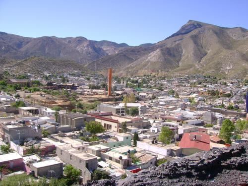 | ||
Concepción del Oro is one of the 58 municipalities in the Mexican state of Zacatecas. It is located on the northern part of the state and it is bounded by the municipalities of Mazapil and El Salvador; it also lies next to the states of Coahuila and San Luis Potosí. The municipality covers a total surface area of 2,559 square kilometers (988 sq mi).
Contents
Map of Concepci%C3%B3n del Oro Municipality, Zacatecas, Mexico
Population
In the 2005 census Concepción del Oro reported a population of 11,857. Of these, 6,653 lived in the municipal seat and the remainder lived in surrounding rural communities.
Economy
Agriculture is one of the main economical activities in Concepción del Oro, it is based in temporary harvesting of mainly: beans, maize, oats, barley and wheat.
References
Concepción del Oro Municipality Wikipedia(Text) CC BY-SA