
 | ||
The table below provides a list of software used in the engineering and construction industries to plan, execute and cost Earthworks (engineering). Earthworks software is a subset of CAD software, it is often the case that earthworks software is in the form of an add-on to a more general CAD package such as AutoCAD rather than a stand alone product.
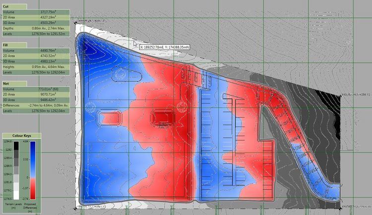
Earthwork software principally is used to calculate cut and fill volumes which are then used for producing material and time estimates. However most products offer additional functionality such as the ability to takeoff terrain elevation from plans (using contour lines and spot heights); produce shaded cut and fill maps; produce cross sections and visualize terrain in 3D.
The means by which volumes are calculated in software can differ quite considerably leading to potentially different results with the same input data. Many software products use methods based on triangulated irregular networks (TINS) and triangular prism volume algorithms, however other calculation methods are in use based on rationalizing elevations into high density grids or cross-sections.