
Country United States FIPS code 28-15500 Elevation 109 m Zip code 38619 Local time Friday 4:51 PM | Time zone Central (CST) (UTC-6) GNIS feature ID 0668729 Area 4.9 km² Population 1,263 (2013) Area code 662 | |
 | ||
Weather 14°C, Wind NE at 5 km/h, 29% Humidity | ||
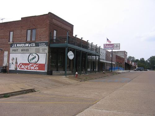
Como is a town in Panola County, Mississippi, which borders the Mississippi Delta and is in the northern part of the state, known as hill country. The population was 1,310 as of the 2000 census. It is in a relatively isolated rural area, which has struggled with the legacy of slavery, segregation and agricultural decline.
Contents
- Map of Como MS 38619 USA
- History
- Notable people
- Geography
- Demographics
- Government and infrastructure
- Education
- References
Map of Como, MS 38619, USA
History
This was a rural area developed for cotton and agriculture, as was the nearby Mississippi Delta, and was dependent on slave labor in the antebellum years. The mechanization of agriculture in the first half of the 20th century meant that many farm workers lost their jobs. The state's legal racial segregation and disenfranchisement had excluded majority-black population from participation in the political system until after passage of the Civil Rights Act of 1964 and the Voting Rights Act of 1965. The relative isolation of the area has made it difficult to develop a new economy.
In a 2007 article about the area, Wayne Drash, a CNN.com senior producer, described Como as "a hard-hit rural community."
Notable people
Geography
Como is located at 34°30′48″N 89°56′29″W (34.513343, -89.941290).
According to the United States Census Bureau, the town has a total area of 1.9 square miles (4.9 km2), of which 1.9 square miles (4.9 km2) is land and 0.53% is water.
It is 45 miles (72 km) south of Memphis, Tennessee.
Demographics
As of the census of 2000, there were 1,310 people, 461 households, and 352 families residing in the town. The population density was 692.1 people per square mile (267.6/km²). There were 506 housing units at an average density of 267.3 per square mile (103.4/km²). The racial makeup of the town was 71.83% African American, 26.79% White, 0.08% Native American, 0.61% from other races, and 0.69% from two or more races. Hispanic or Latino of any race were 1.15% of the population.
There were 461 households out of which 34.5% had children under the age of 18 living with them, 39.7% were married couples living together, 31.0% had a female householder with no husband present, and 23.6% were non-families. 22.1% of all households were made up of individuals and 11.9% had someone living alone who was 65 years of age or older. The average household size was 2.84 and the average family size was 3.30.
In the town, the population was spread out with 30.1% under the age of 18, 9.8% from 18 to 24, 24.5% from 25 to 44, 20.6% from 45 to 64, and 15.0% who were 65 years of age or older. The median age was 34 years. For every 100 females there were 81.2 males. For every 100 females age 18 and over, there were 74.8 males.
The median income for a household in the town was $22,344, and the median income for a family was $25,000. Males had a median income of $28,333 versus $18,977 for females. The per capita income for the town was $12,278. About 31.3% of families and 37.5% of the population were below the poverty line, including 57.2% of those under age 18 and 29.6% of those age 65 or over.
Government and infrastructure
The United States Postal Service operates the Como Post Office.
Education
The Town of Como is served by the North Panola School District. Como Elementary School in Como, North Panola Junior High School in Como, and North Panola High School in Sardis serve the community. Wayne Drash, a CNN.com senior producer, said in a 2007 article that one school in Como was considered to be among the lowest-performing in the United States.