
 | ||
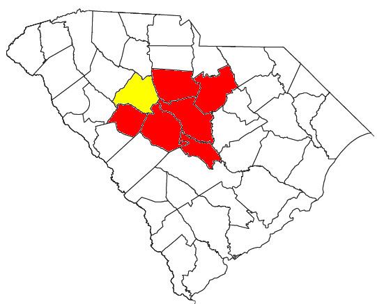
As defined by the U.S. Office of Management and Budget, and used by the U.S. Census Bureau for statistical purposes only, the Columbia Metropolitan Statistical Area, is an area consisting of six counties in central South Carolina, anchored by the city of Columbia. As of the 2010 census, the MSA had a population of 767,598; as of the 2015 census estimates, the population is 810,068. It is the second-largest metropolitan statistical area in the state of South Carolina, since the Anderson metropolitan statistical area was combined with Greenville's following the 2010 census.
Contents
Counties
Places with more than 100,000 inhabitants
Places with 10,000 to 25,000 inhabitants
Places with 5,000 to 10,000 inhabitants
Places with 1,000 to 5,000 inhabitants
Places with less than 1,000 inhabitants
Demographics
As of the census of 2010, there were 767,598 people, 294,881 households, and 193,598 families residing within the MSA. The racial makeup of the MSA was 60.40% White, 33.20% African American, 0.40% Native American, 1.70% Asian, 0.10% Pacific Islander, 2.30% from other races, and 2.00% from two or more races. Hispanic or Latino of any race were 5.10% of the population.
The median income for a household in the MSA was $49,238, and the median income for a family was $61,972. Males had a median income of $43,658 versus $35,891 for females. The per capita income for the MSA was $25,615.
Combined Statistical Area
The Columbia-Combined statistical Area is made up of eight counties in central South Carolina. The statistical area includes one metropolitan area. As of the 2015 Census estimates, the CSA had a population of 937,288 and is the second-largest CSA in the state.