
Type Street | Length 700 m (0.4 mi) Major cities Sydney | |
 | ||
North end Junction of the Prince Albert, St Marys, and Art Gallery roads South end | ||
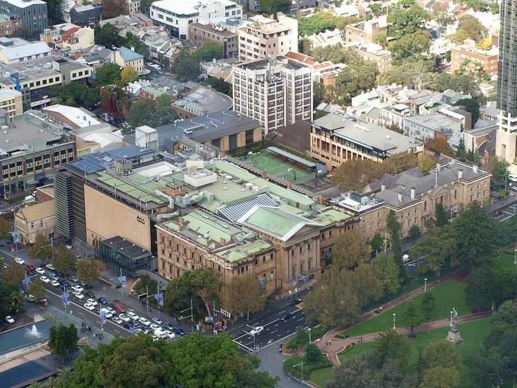
College Street is a 700-metre (2,300 ft) major street in the central business district of Sydney in New South Wales, Australia. From north to south, it runs from east of Queens Square and St James station to start at the junction of the Prince Albert, St Marys, and Art Gallery roads and runs to Whitlam Square, at Liverpool Street. The street runs beside the eastern border of Hyde Park, and is lined by the Australian Museum, Sydney Grammar School, Cook and Phillip Park Aquatic and Fitness Centre, and St Mary's Cathedral.
Map of College St, Marion, VA 24354, USA
An electric tramway formerly ran down College St. It was closed in 1960.
References
College Street, Sydney Wikipedia(Text) CC BY-SA