
OS grid reference SU709728 | Sovereign state United Kingdom | |
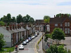 | ||
Coley is an inner-town district near the centre of the town of Reading, in the English county of Berkshire. It is often referred to as Old Coley, to distinguish it from the adjacent, and much more recent, suburb of Coley Park.
The district has no formal boundaries, but the historically the name referred to the area roughly bounded by Castle Street, Castle Hill and the Bath Road to the north, Berkeley Avenue to the south and west, and the River Kennet and Bridge Street to the east. Coley is bordered to its south and west by Coley Park, to its north by West Reading, and to its east by Katesgrove and the Inner Distribution Road.
The district lies entirely within the borough of Reading, within Minster and Abbey wards. It is within the Reading West parliamentary constituency.
Coley is split between the Church of England parishes of All Saints Church and St Giles' Church, although neither church is actually within the district.
The Berkshire Record Office is located in Coley Avenue near to the junction with Bath Road.
Coley formerly had a railway goods yard, the Reading Central Goods station, which was connected to the main line at Southcote Junction by the Coley branch line.