
Time zone Eastern (EST) (UTC-5) Population 5,070 (2010) | State New York Elevation 33 ft (10 m) ZIP code(s) 11724, 11743 | |
 | ||
Weather 9°C, Wind W at 27 km/h, 57% Humidity University Watson School of Biological Sciences Points of interest Cold Spring Harbor St, Cold Spring Harbor W, Uplands Farm Sanctuary, Cold Spring Harbor Fi | ||
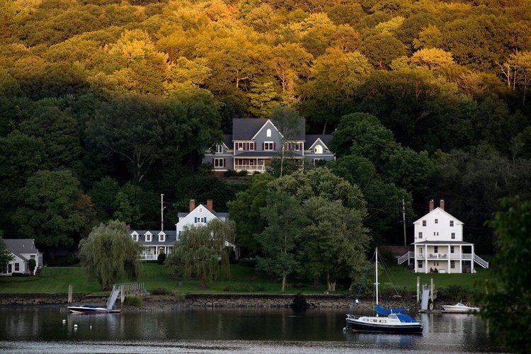
Cold Spring Harbor is a hamlet and census-designated place (CDP) in the town of Huntington, Suffolk County, New York, on the North Shore of Long Island. As of the 2010 United States Census, the CDP population was 5,070.
Contents
- Map of Cold Spring Harbor NY USA
- History
- Geography
- Demographics
- Notable people
- In popular culture
- References
Map of Cold Spring Harbor, NY, USA
History
Cold Spring Harbor was named after the naturally cold freshwater springs that flow in the area. Its economy mainly tied to milling and port activities, it rose in prominence as a whaling community in the mid-nineteenth century. After the decline of whaling in the 1860s, it became a resort town with several hotels. In the 20th century it became known as the site of Cold Spring Harbor Laboratory, although the laboratory itself is located in the adjacent village of Laurel Hollow in Nassau County which was called Cold Spring, before incorporation.
Today it is primarily a bedroom community of New York City, with a small central business area running along Route 25A, and is home to many educational and cultural organizations: the Cold Spring Harbor Whaling Museum, the Cold Spring Harbor Fish Hatchery and Aquarium, Dolan DNA Learning Center, the Uplands Farm Sanctuary (home of The Nature Conservancy's Long Island chapter), and a gallery run by the Society for the Preservation of Long Island Antiquities.
Geography
Cold Spring Harbor is located at 40°52′N 73°27′W (40.863, -73.443).
According to the United States Census Bureau, the CDP has a total area of 3.9 square miles (10 km2), of which 3.7 square miles (9.6 km2) is land and 0.2 square miles (0.52 km2), or 4.86%, is water.
Demographics
As of the census of 2000, there were 4,975 people, 1,753 households, and 1,416 families residing in the CDP. The population density was 1,336.3 per square mile (516.4/km²). There were 1,790 housing units at an average density of 480.8/sq mi (185.8/km²). The racial makeup of the CDP was 97.03% White, 0.42% African American, 0.02% Native American, 1.31% Asian, 0.24% from other races, and 0.98% from two or more races. Hispanic or Latino of any race were 1.97% of the population.
There were 1,753 households out of which 38.8% had children under the age of 18 living with them, 71.8% were married couples living together, 7.1% had a female householder with no husband present, and 19.2% were non-families. 14.9% of all households were made up of individuals and 5.8% had someone living alone who was 65 years of age or older. The average household size was 2.84 and the average family size was 3.15.
In the CDP, the population was spread out with 26.7% under the age of 18, 4.2% from 18 to 24, 28.9% from 25 to 44, 26.9% from 45 to 64, and 13.4% who were 65 years of age or older. The median age was 40 years. For every 100 females there were 94.9 males. For every 100 females age 18 and over, there were 92.1 males.
The median income for a household in the CDP was $101,122, and the median income for a family was $112,441. Males had a median income of $78,984 versus $44,464 for females. The per capita income for the CDP was $52,403. About 1.3% of families and 2.2% of the population were below the poverty line, including 0.4% of those under age 18 and 3.6% of those age 65 or over.