Local time Wednesday 8:34 AM | ||
 | ||
Weather 11°C, Wind N at 8 km/h, 84% Humidity | ||
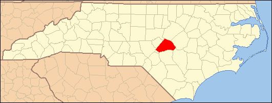
Cokesbury is an unincorporated community located in the Buckhorn Township of Harnett County, North Carolina. It is a part of the Dunn Micropolitan Area, which is also a part of the greater Raleigh–Durham–Cary Combined Statistical Area (CSA) as defined by the United States Census Bureau.
Contents
Map of Cokesbury, Buckhorn, NC 27526, USA
The community was named for Methodist bishops Thomas Coke and Francis Asbury. The Buckhorn Iron Furnace, a former landmark near here, operated during the American Civil War until 1873 (Powell 1968, p. 112).
History
According to 19th and early 20th century maps, Cokesbury was originally known as Chalk Level. In 1889, Chalk Level had a population of 65. There were two churches, Cokesbury Methodist and Cumberland Union Baptist, and two ministers, but both of them were Methodist. Three physicians lived in Chalk Level, but no lawyers. Chalk Level had three blacksmiths, one cooper and six other businesses, including three general stores, a fertilizer store, a lumber seller and an auctioneer. Other nearby businesses included the Buckhorn Coal Mine, the Cape Fear Steel and Iron Mine, two flour mills and one woolen mill.
Chalk Level had one school, the Cokesbury Academy, and one teacher, J.A. Cameron (Branson 1890, pp. 349–52).
The earliest map to show the change from Chalk Level to Cokesbury is a 1916 Harnett County soil map produced by the North Carolina Department of Agriculture.
For 19th and early 20th century maps showing Cokesbury as Chalk Level, go to http://www.lib.unc.edu/dc/ncmaps/
