
Population 1,693 (2011 census) Area 80 ha | Postcode(s) 2093 Postal code 2093 | |
 | ||
LGA(s) | ||
Clontarf is a suburb of northern Sydney, in the state of New South Wales, Australia. Clontarf is located 13 kilometres north-east of the Sydney central business district in the local government area of Northern Beaches Council, in the Northern Beaches region.
Contents
Map of Clontarf NSW 2093, Australia
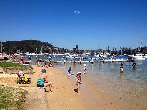
Landmarks
Clontarf Beach, Sandy Bay, Castle Rock, Grotto Point.
History
Clontarf is named after the Clontarf district in Dublin, Ireland.
The son of Queen Victoria, Prince Alfred, Duke of Edinburgh visited Clontarf in 1868 where he was shot in the back by an Irishman, Henry James O'Farrell. Alfred was ingloriously saved because the bullet struck him at a point where his India-rubber braces, holding his trousers up, crossed over. The bullet was deflected around his rib-cage and did no major harm.
Demographics
According to the 2011 census, there were 1,693 residents in Clontarf. 67.8% of people were born in Australia; the most common other countries of birth were England 10.5%, United States of America 2.3% and New Zealand 1.5%. Their median age was 42 years, compared to the national median of 37 years, while children aged under 15 years made up 21.9% of the population (national average is 19.3%) and people aged 65 years and over made up 15.8% of the population (national average is 14.0%). The median household income in Clontarf was $2,740 per week, which is more than double the national median of $1,234, and the highest in Australia. With high incomes, Clontarf residents also have high housing costs. The median mortgage payment was $4,000 per month compared to $1,800 for all of Australia. The story is similar for rented properties; the median weekly rent was $1,100 compared to $285 for all of Australia.