
Founded June 21, 1839 Largest city Lock Haven Time zone Eastern: UTC-5/-4 Population 39,954 (2013) County seat Lock Haven | Named for DeWitt Clinton Congressional district 5th Area 2,323 km² Unemployment rate 6.3% (Apr 2015) | |
 | ||
Website www.clintoncountypa.com University Lock Haven University of Pennsylvania Destinations Lock Haven, Renovo, Sproul State Forest, Hyner View State Park, Mill Hall Points of interest Piper Aviation Museum, Kettle Creek State Park, Hyner Run State Park, Bald Eagle Mountain, Burns Run Wild Area | ||
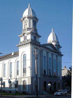
Visit clinton county pennsylvania
Clinton County is a county located in the U.S. state of Pennsylvania. As of the 2010 census, the population was 39,238. Its county seat is Lock Haven. The county was created on June 21, 1839, from parts of Centre and Lycoming Counties. Its name is in honor of the seventh Governor of New York State, DeWitt Clinton, however some sources suggest the namesake is Henry Clinton.
Contents
- Visit clinton county pennsylvania
- Map of Clinton County PA USA
- Geography
- Adjacent counties
- Landforms
- Demographics
- Micropolitan Statistical Area
- Government and politics
- County commissioners
- Other county offices
- Colleges and universities
- Public school districts
- Recreation
- Communities
- City
- Boroughs
- Census designated places
- Population ranking
- References
Map of Clinton County, PA, USA
Clinton County comprises the Lock Haven, PA Micropolitan Statistical Area, which is also included in the Williamsport-Lock Haven, PA Combined Statistical Area.
Geography
According to the U.S. Census Bureau, the county has a total area of 897 square miles (2,320 km2), of which 888 square miles (2,300 km2) is land and 8.9 square miles (23 km2) (1.0%) is water.
Adjacent counties
Landforms
Demographics
As of the census of 2000, there were 37,914 people, 14,773 households, and 9,927 families residing in the county. The population density was 43 people per square mile (16/km²). There were 18,166 housing units at an average density of 20 per square mile (8/km²). The racial makeup of the county was 98.29% White, 0.52% Black or African American, 0.11% Native American, 0.40% Asian, 0.02% Pacific Islander, 0.15% from other races, and 0.52% from two or more races. 0.54% of the population were Hispanic or Latino of any race. 36.0% were of German, 15.6% American, 9.6% Irish, 8.6% Italian and 7.4% English ancestry according to Census 2000.
There were 14,773 households out of which 27.70% had children under the age of 18 living with them, 54.00% were married couples living together, 9.40% had a female householder with no husband present, and 32.80% were non-families. 26.60% of all households were made up of individuals and 13.60% had someone living alone who was 65 years of age or older. The average household size was 2.42 and the average family size was 2.90.
In the county, the population was spread out with 21.50% under the age of 18, 13.60% from 18 to 24, 25.50% from 25 to 44, 22.70% from 45 to 64, and 16.80% who were 65 years of age or older. The median age was 38 years. For every 100 females there were 94.20 males. For every 100 females age 18 and over, there were 91.20 males.
Micropolitan Statistical Area
The United States Office of Management and Budget has designated Clinton County as the Lock Haven, PA Micropolitan Statistical Area (µSA). As of the 2010 U.S. Census the micropolitan area ranked 16th most populous in the State of Pennsylvania and the 315th most populous in the United States with a population of 39,238. Clinton County is also a part of the Williamsport-Lock Haven, PA Combined Statistical Area (CSA), which combines the population of both Clinton County and the Lycoming County areas. The Combined Statistical Area ranked 11th in the State of Pennsylvania and 143rd most populous in the United States with a population of 155,349.
Government and politics
As of February 24, 2014, there were 20,246 registered voters in Clinton County.
While Clinton County has historically been Republican like the rest of central Pennsylvania, Democrats captured the registration edge in early 2008. Each of the three row-office statewide winners carried Clinton in 2008. In 2006, Democrat Bob Casey Jr. received 54% of its vote when he unseated incumbent Republican US Senator Rick Santorum and Ed Rendell received 56% of the vote against Lynn Swann. The conservative tendencies of the county were again reestablished in 2008 when then-Senator Obama lost the county vote 47.98% to John McCain's 50.73%. This was followed in 2010 with U.S. Senate candidate, Republican Pat Toomey, receiving 58.69% to 41.31% for Democrat Joe Sestak. In 2012, Mitt Romney carried the county 55.05% to President Obama's 43.23%, while incumbent Democratic Senator Bob Casey, Jr. received 44.47% to his Republican challenger, Tom Smith's 53.29% [1].
County commissioners
Other county offices
Colleges and universities
Public school districts
Recreation
There are five Pennsylvania state parks in Clinton County.
Communities
Under Pennsylvania law, there are four types of incorporated municipalities: cities, boroughs, townships, and, in at most two cases, towns. The following cities, boroughs and townships are located in Clinton County:
City
Boroughs
Census-designated places
Census-designated places are geographical areas designated by the U.S. Census Bureau for the purposes of compiling demographic data. They are not actual jurisdictions under Pennsylvania law. Other unincorporated communities, such as villages, may be listed here as well.
Population ranking
The population ranking of the following table is based on the 2010 census of Clinton County.
† county seat