
Status Operational Height 44 m Surface area 18.1 km² | Purpose Power Type of dam Gravity Opened 1939 | |
 | ||
Opening date 1939; 78 years ago (1939) Similar New River, Claytor Lake, Blue Ridge Mountains, Kerr Dam, Smith Mountain Dam | ||
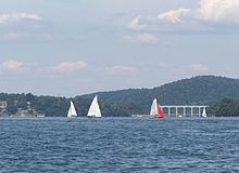
The Claytor Dam is a gravity dam on the New River in Pulaski County, Virginia, United States. It is also located about 2.5 mi (4.0 km) south of Radford. It is named after William Graham Claytor, then vice president of Appalachian Power Company (APC), who was instrumental in the dam's construction. APC is now a subsidiary of American Electric Power (AEP) who owns the dam. The primary purpose of the dam is hydroelectric power generation and it supports a 75 MW power station. Its reservoir, Claytor Lake, is also used for recreation. The dam was constructed and its power station commissioned in 1939. It received its first license in 1943. It is 1,142 ft (348 m) long and 145 ft (44 m) tall. It stores a reservoir with a capacity of 225,000 acre·ft (278,000,000 m3). The reservoir covers 4,472 acres (1,810 ha) and stretches 21.67 mi (34.87 km) behind the dam.