
Country United States Time zone CST (UTC-6) Elevation 212 m Local time Monday 4:26 PM | Established November 6, 1849 ZIP codes 62320, 62324, 62339 Area 95.73 km² Population 1,027 (2010) | |
 | ||
Weather 20°C, Wind S at 35 km/h, 67% Humidity | ||
Clayton Township is one of twenty-two townships in Adams County, Illinois, United States. As of the 2010 census, its population was 1,027 and it contained 465 housing units.
Contents
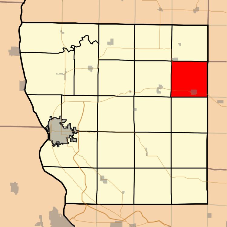
- Map of Clayton Township IL USA
- History
- Geography
- Cities
- Unincorporated towns
- Cemeteries
- Major highways
- School districts
- Political districts
- References
Map of Clayton Township, IL, USA
History
Clayton Township is named for Kentucky statesman Henry Clay.
Geography
According to the 2010 census, the township has a total area of 36.96 square miles (95.7 km2), of which 36.95 square miles (95.7 km2) (or 99.97%) is land and 0.01 square miles (0.026 km2) (or 0.03%) is water.
Cities
Unincorporated towns
(This list is based on USGS data and may include former settlements.)
Cemeteries
The township contains six cemeteries: Evangelical Lutheran, Meints, Pleasant View, Sargent, South Side and West Side.
Major highways
School districts
Political districts
References
Clayton Township, Adams County, Illinois Wikipedia(Text) CC BY-SA