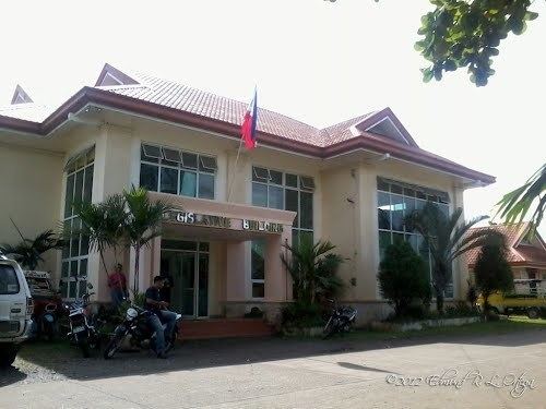
Country Philippines Established 1955 Time zone PST (UTC+8) Local time Tuesday 4:53 AM | Region Caraga (Region XIII) Barangays Area 322.6 km² Province Surigao del Norte | |
 | ||
District 2nd district of Surigao del Norte Weather 24°C, Wind SW at 0 km/h, 95% Humidity Neighborhoods Taganito, Daywan, Hayanggabon, Tayaga | ||
Taganito burning incident claver surigao del norte
Claver is a first-class municipality in the province of Surigao del Norte, Philippines. With a total land area of 322.60 square kilometres (124.56 sq mi), it is the largest municipality of the province. According to the 2015 census, it has a population of 32,773 people.
Contents
- Taganito burning incident claver surigao del norte
- Map of Claver Surigao del Norte Philippines
- Lakbay salamin silipin barangay taganito claver surigao del norte
- World War II
- Barangays
- Economy
- References
Map of Claver, Surigao del Norte, Philippines
In the north-east, it is bounded by the Pacific Ocean, to the west by the town of Gigaquit, and to the south by the boundary town of Carrascal, Surigao del Sur. It is approximately 60 kilometres (37 mi) southeast of the provincial capital, Surigao City. The town can be reached by bus, van-for-hire and jeepney from the Surigao Integrated Bus & Jeepney Terminal or at any point along the national highway. Its patron saint is St. Peter Claver and fiesta is celebrated every ninth day of September.
A large part of the municipal land area is a mining reservation because there are large iron mineral deposits.
Lakbay salamin silipin barangay taganito claver surigao del norte
World War II
Claver was one of many coastal towns that for some time were ignored after the American and Filipino military forces surrendered to the Japanese in May 1942. Claver became the headquarters of the 114th Infantry Regiment of 10th Military District, which was the guerrilla organization under the jurisdiction of the United States Army. Some residents had fled for fear of a Japanese raid or occupation of the town, but an American whose family took refuge there said Claver still had a feeling of normalcy to it. On a hill above town the guerrillas maintained a radio station by which they kept in contact with other military units. The radio operator decided, without the knowledge of his superiors, to jam wavelengths used by the Japanese. The Japanese got a fix on the location of the station as a result.
On November 30, 1943, the Japanese took action to put the radio station out of business. Very early in the morning several Japanese ships appeared off the coast and began shelling the town with five-inch guns. After a prolonged shelling, Japanese troops landed and destroyed the radio station. The guerrillas left as the Japanese entered town and moved their headquarters elsewhere. Because the town had supported the guerrillas, the town was ransacked. The troops then returned to the ships, which left.
Most of the residents fled south to avoid the Japanese, who did not occupy Claver. Claver remained almost abandoned until the end of the war.
Barangays
Claver is politically divided into 15 barangays:
Economy
Claver is primarily a mining town with iron deposits on its mountains. Mining, trading, farming and fishing are the main sources of livelihood among residents.
