
Population 209 (2011) Civil parish Claughton Dialling code 01524 | OS grid reference SD562664 Sovereign state United Kingdom | |
 | ||
Claughton (/ˈklæftən/ KLAF-tən) is a small village and civil parish in the City of Lancaster in Lancashire, England. The village is on the A683 road east of Lancaster and at the 2001 census had a population of 132, increasing to 209 at the 2011 Census.
Contents
Map of Claughton, Lancaster, UK
North of the village is the River Lune, and to the south is Claughton Moor and the fells of the Forest of Bowland.
Local government
Claughton is part of the Lower Lune Valley ward, which elects two councillors to Lancaster City Council every 4 years.
Industry
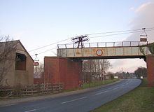
There is a brick works in the village, and aerial ropeways above the road transport clay from Claughton Moor.
Religious sites
St Chad's Church was closed by the Church of England in 2002 due to a decline in the number of worshippers and the fact that the building was in need of modernisation. The church was part of the Hornby with Claughton parish. There was a church on the site as early as 1100.
Railway
The railway station (actually a crossing cottage) was on the "Little" North Western Railway at 54°05′43.47″N 2°40′2.15″W. Trains running between Lancaster Green Ayre railway station and Wennington railway station stopped at Claughton between Caton and Hornby. In 1853, for example, the 11am from Morecambe to Skipton called at Claughton at 11.35.