
Founded 1854 Area 3,157 km² | Named for William Clark Website www.co.clark.wi.us Population 34,615 (2013) Unemployment rate 4.4% (Apr 2015) | |
 | ||
Rivers Little Eau Pleine River, East Fork Black River, Lead Creek Points of interest The Highground, Russell Memorial Park and, Rock Dam County Park & C, Levis Mound, Clark County Jail | ||
Jackson county clark county wisconsin atv trails
Clark County is a county located in the U.S. state of Wisconsin. As of the 2010 census, the population was 34,690. Its county seat is Neillsville.
Contents
- Jackson county clark county wisconsin atv trails
- Map of Clark County WI USA
- History
- Geography
- Adjacent counties
- Airport
- Demographics
- Villages
- Census designated places
- Ghost towns
- References
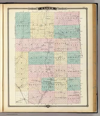
Map of Clark County, WI, USA
History
Clark County was founded in 1853 and organized the following year. It was named for A. W. Clark, an early settler, or for General George Rogers Clark.
Geography
According to the U.S. Census Bureau, the county has a total area of 1,219 square miles (3,160 km2), of which 1,210 square miles (3,100 km2) is land and 9.0 square miles (23 km2) (0.7%) is water.
Adjacent counties
Airport
Demographics
As of the census of 2000, there were 33,557 people, 12,047 households, and 8,673 families residing in the county. The population density was 28 people per square mile (11/km²). There were 13,531 housing units at an average density of 11 per square mile (4/km²). The racial makeup of the county was 98.05% White, 0.13% Black or African American, 0.48% Native American, 0.30% Asian, 0.01% Pacific Islander, 0.56% from other races, and 0.47% from two or more races. 1.20% of the population were Hispanic or Latino of any race. 54.0% were of German, 9.0% Polish, 6.2% Norwegian and 6.1% United States or American ancestry according to Census 2000. 6.62% reported speaking German, Pennsylvania German, or Dutch at home; an additional 1.34% speak Spanish.[1]
There were 12,047 households out of which 35.00% had children under the age of 18 living with them, 61.20% were married couples living together, 6.50% had a female householder with no husband present, and 28.00% were non-families. 23.80% of all households were made up of individuals and 12.60% had someone living alone who was 65 years of age or older. The average household size was 2.73 and the average family size was 3.27.
In the county, the population was spread out with 29.90% under the age of 18, 7.70% from 18 to 24, 26.20% from 25 to 44, 20.20% from 45 to 64, and 16.00% who were 65 years of age or older. The median age was 36 years. For every 100 females there were 100.50 males. For every 100 females age 18 and over, there were 98.70 males.